DSS Supports Original Undergraduate Research Using GIS

Which road systems were built along Native American trail ways, and why?  This research question, formulated by Molly Leech ’17 for her senior thesis in Anthropology and Sociology under the supervision of Professor Andrea Smith, represents the sort of historic geographic scholarly inquiry that John Clark, Data Visualization GIS Librarian, loves to support in his role at Skillman Library Digital Scholarship Services (DSS).  John offers a “Making Maps” workshop series at the Skillman Library that introduces students, faculty, and librarians to such tools as Google Maps, Social Explorer, and ArcGIS, a popular desktop GIS (Geographic Information Systems) application available to the Lafayette community at Skillman.  He also supports faculty and student research projects such as Molly’s.  While attending John’s “Making Maps” workshops to learn about digital tools she might use to explore her thesis topic geographically, Molly had the opportunity to share her research question with John, and she now works closely with him on a substantive GIS component for her thesis.

According to John, “maps and geographic understanding are relevant to nearly every major at the college–from Environmental Science to History to Civil Engineering and all points in between. Furthermore, mapping software has become simpler to use so that students can create their own geospatial data from spreadsheets or by extracting information from historic maps. This data can then used to make their own custom maps. I can assist students, whether it’s finding the right map online for a class assignment or assisting them with mapping software so that they can create maps from their own research.”

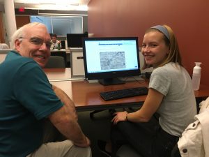
GIS Librarian John Clark works with Molly Leech '17

GIS Librarian John Clark (left) works with Molly Leech ’17 (right)

Molly explains that a geographic lens has been central to the development of her research. “My thesis retraces the history of two former Indian trails that intersect at the historic ‘Four Corners’ of Shrewsbury, New Jersey. By contextualizing maps from the late seventeenth century to present day with archival source material such as town histories and newspaper articles, I hope to reveal how these Indian trails transitioned to early colonial and present-day roads. This research allows me to explore the processes involved in the creation of a settler sense of belonging as well as the politics of street-naming and place-making.”
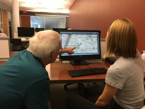
IMG_0073Molly emphasizes that the GIS component of her thesis is crucial to understanding her topic. “It’s not an easy job to try to locate these former Indian trails on the landscape–archival sources often use long-gone farms and homesteads as geographic points of reference.  Luckily, with the help of John Clark, I’ve been able to use archival maps from the same time period as my sources to retrace the Indian trails and then overlay present-day road maps onto this data. When I began my thesis research, I didn’t expect to be using GIS, but now, these compiled maps will be presented as part of my thesis to help re-conceptualize our surroundings and challenge the dominant narrative of Northeastern American colonial history.”

For Molly, her GIS exploration is thus central to her critical examination of settler colonial narratives in American history.  “There’s something to be said about the fact that we don’t tend to talk about the fact that many of the roads we drive on are former Indian trails. When we think of pre-colonial America, the dominant narrative is that settlers encountered an untamed wilderness; the idea of the intrepid pioneer is glorified. However, it makes complete sense that a settler nation would make use of the indigenous populations’ trails, and indeed start to settle along them. When we are conscious that we are driving on former Indian trails, we are reminded of our colonial history and we become more conscious of the longtime presence of Native Americans on the land.”

Are you interested in incorporating a mapping component in your research or teaching?  Contact John Clark at clarkjh@lafayette.edu.

DSS contributes to developer community at HydraConnect 2015

hydra_logo_h200_transparent_bgLafayette’s Digital Scholarship Services is once again in the forefront of library repository development. At this year’s HydraConnect Conference, DSS developer James Griffin shared his work with the burgeoning community of Hydra developers.

Hydra is an Open Source software that, together with the repository system Fedora, forms the basis of many institutional repositories and is the foundation for preservation and discovery for many digital archives. Griffin is part of a working group looking to expand the uses of Hydra to include the preservation and display of GIS data within library repository systems. While this kind of work is largely invisible to the casual user, it can make a lasting impact on future development.

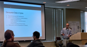
Hydra_James_podium

DSS Developer James Griffin presenting on Geospatial Data in Hydra

In designing the architecture of this new functionality, Griffin finds himself in excellent company working with a handful of other like-minded developers from Stanford, Princeton, and the University of Alberta, who form the GIS Data Modeling Working Group. The conference provided the occasion for the group to present their initial data models. In these initial stages, the group has begun to break down the complex data components of GIS files into a structure compatible with the repository’s internal organization and consistent with existing data models for other types of information.

The group participated in a poster session and also sponsored an “unconference” session, a free form discussion whose topics are determined by the conference goers. In addition, Griffin presented a lightning talk on their data model. “Our presentations have generated a lot of interest in how we have addressed our use cases using linked open data in the Resource Description Framework,” explains Griffin. “While few are working on GIS related projects our project gives weight to the idea that Hydra is flexible and versatile. It’s more than just a repository solution.” This work, now cutting edge, will help to guide future development in Hydra and expand its potential applications in digital library infrastructure.

Through Griffin’s work, Lafayette is an increasingly important player in this arena and the working group will present their latest developments next month at the Digital Library Federation conference in Vancouver, and at the Geo4LibCamp at Stanford University in January.


GIS Workshop: Exploring Google Maps

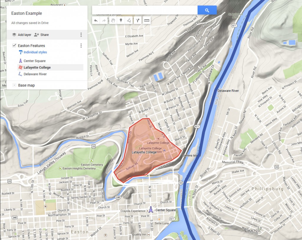
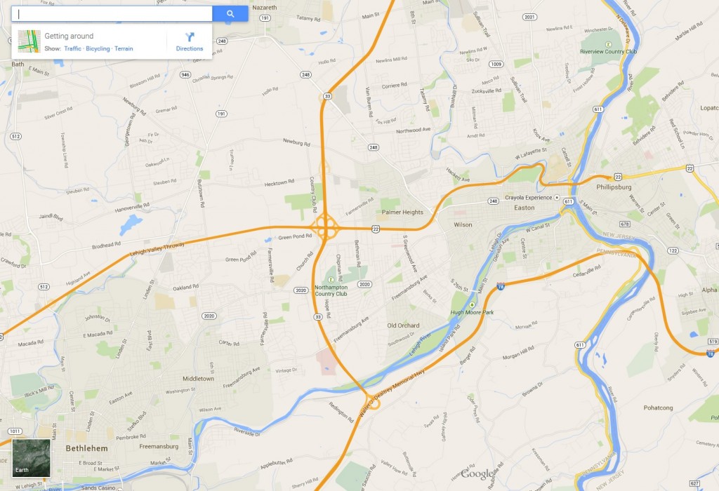
EastonExample_GoogleMapsThere is a lot more to Google Maps than meets the eye. Join John Clark, DSS’ Data Visualization & GIS Librarian, for a glimpse of what goes on “under the hood” of this online mapping resource and how you can use it to make your own customized maps. Participants will learn how to contribute their own content to a Google Map as well as many other tips and tricks for creating useful and well designed maps with nothing more than a web browser. Windows laptops will be provided for all participants, but feel free to bring your own.

This workshop will be held twice, first on October 16 and then repeated on October 21.

Friday,  October 16 12:15 pm to 1:00pm Skillman 003
Wednesday, October 21 12:15 pm to 1:00pm Skillman 004

Lunch provided. Please RSVP John Clark (clarkjh@lafayette.edu), indicating the date you would like to attend.

GIS Workshop: A Very Brief Introduction to Geographical Information Systems (GIS)

Geographic Information Systems (GIS) are a powerful, yet easily accessible technology, used for analyzing and mapping information about the world around us.

Screen Shot 2015-09-09 at 3.06.44 PMIn this workshop participants will be given an introduction to basic geographic and information science concepts followed by a demonstration of ArcGIS, a popular desktop GIS application available to the Lafayette community at Skillman Library.

A second, optional workshop (Part 2), will be available the following week and will offer hands-on training using WorldMap, a simple, intuitive and free on-line GIS application. You may take the first workshop as a complete, albeit brief, introduction to GIS or you may sign up for the series of two.

Part I: Introduction Weds. Sept. 23
Part II: Workshop (optional) Weds. Sept. 30

Both workshops will take place in Skillman 003 from 12:15pm to 1:00pm. 18 seats available. Lunch provided.

Please RSVP John Clark clarkjh@lafayette.com and indicate if you would like to take one or both workshops and which dates you would like to attend.


GIS Workshop: Beware of Maps – a beginner’s guide to reading and making maps

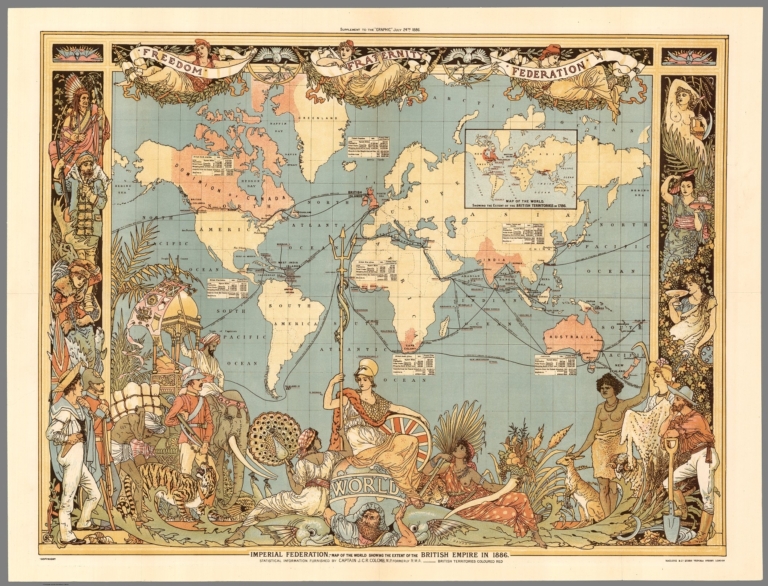
SkillmanWebsite_BewareOfMapsReading a map is trickier than you might expect. While maps casually present themselves as a visualization of reality, the truth is, they aren’t. All maps are imperfect models of natural and cultural features on the surface of the Earth. Reading a map involves understanding how a map maker has chosen to represent these features and, perhaps more importantly, what s(he) has left out. Join Data Visualization & GIS Librarian John Clark for a guided tour through a variety of different historical and contemporary maps as he explains some common principals used by cartographers. Participants will then have an opportunity to make a map themselves using Social Explorer, an on-line mapping tool available to the Lafayette community through Skillman Library.

There are two sessions available:

Wednesday September 16th             Skillman 003

OR

Friday September 18th Skillman 004

Lunch provided.18 seats available for each session. Please RSVP and indicate if you would like to attend the Wednesday or Friday event to John Clark at clarkjh@lafayette.com.

GIS Workshop: Exploring Google Maps

GoogleMaps_screenshot

There is a lot more to Google Maps than meets the eye. Join John Clark, DSS’ Data Visualization & GIS Librarian, for a glimpse of what goes on “under the hood” of this online mapping resource and how you can use it to make your own customized maps. Participants will learn how to contribute their own content to a Google Map as well as many other tips and tricks for creating useful and well designed maps with nothing more than a web browser. Windows laptops will be provided for all participants, but feel free to bring your own.

This workshop will be held twice, first on April 1 and then repeated on April 3.

Wednesday, April 1: 12:10 –1:00pm             Skillman Library Room 004

Friday, April 3: 12:10 –1:00pm                      Skillman Library Room 004

Lunch provided. Please RSVP  to John Clark, Data Visualization & GIS Librarian, indicating the date you would like to attend. clarkjh@lafayette.edu


For more information about this workshop or on starting a digital project with DSS e-mail digital@lafayette.edu, or call (610) 330-5796.

DSS’ John Clark contributes to the Historical Atlas of Maine

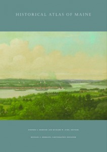
ATLASimageforstoreWork by DSS’s John Clark, Data Visualization & GIS Librarian at Skillman Library, will soon appear in print. John is a contributor to the Historical Atlas of Maine (University of Maine Press, 2015). The Atlas, edited by Stephen J. Hornsby and Richard W. Judd with cartographic design by Michael Hermann, traces the historical geography of Maine from the ice age through to the year 2000. It includes a cartographic narrative of the long history of Maine stretching from the history of the region’s native peoples, through to industrialization and the rise of tourism. This extensive collection is the culmination of work by many hands stretching over more than a decade at a cost of nearly one million dollars. Funding for the project was provided principally by the National Endowment for the Humanities, the State of Maine, the University of Maine, and a number of private foundations.

John is one of a number of contributors and was responsible for five of the seventy-six atlas plates. These responsibilities included the overall development of the textual and visual narratives presented in the plates as well as the extensive archival research and historical GIS development that went into the original maps, graphics, and archival images which form the narrative elements of the plates.

John’s research focused on the development of energy resources and transportation between the mid-19th and the late-20th centuries and his work includes plates on railroads, streetcars, electrification, and the rise of the automobile. Each one documents how economic and technological development mixed with the state’s regional culture, creating unique patterns of modernity in Maine which persist to this day.

The book will be available for purchase from the University of Maine Press and on the shelves at Skillman Library later this month.


For more information on starting a digital project with DSS or applying for an internship opportunity contact us at digital@lafayette.edu, or call (610) 330-5796.

John Clark and GIS at the Social Science History Association Conference

sshaJohn Clark, Data Visualization & GIS Librarian with Skillman Library’s Digital Scholarship Services department participated in the 39th Annual Meeting of the Social Science History Association in Toronto this week. Over the course of four days John participated in and chaired a number of sessions featuring cutting edge research projects in digital and spatial history.

The Association brings together a broad interdisciplinary group of historians and social scientists organized in a variety of thematic research networks. The Historical Geography network, for which he serves as a co-chair, features many of the earliest adopters in the use of Geographical Information Systems in historical research and for many years has been one of the principal venues for the presentation of innovative work creating new spatial histories and historical geographies through GIS research methods.

The presentations at this year’s conference reflected continued growth in these methodologies that now reach beyond desktop GIS tools to include the development of web-based virtual research environments (VRE) much like those under development at Skillman Library’s Digital Scholarship Services repository.

While at the conference John chaired two sessions. The first focused on progress made at the Collaborative in Historical Information and Analysis (CHIA) at the University of Pittsburgh’s World History Center where researchers are creating a world-historical data archive covering the past four centuries along with a data integration tool, Col*Fusion, aimed at harmonizing and normalizing datasets from a wide variety of knowledge domains.

The second, a roundtable titled Historical Atlases, Yesterday and Today featured a lively discussion of the genre while focusing on two recent publications; the Historical Atlas of Maine (University of Maine Press, 2015) and the digital republication (University of Richmond Digital Scholars Lab, 2013) of the classic Atlas of the Historical Geography of the United States (Carnegie Institution and American Geographical Society, 1932) featuring animations and other web-GIS functions applied to the original content.

The sessions will be of interest to both digital humanities scholars and social science researchers at Lafayette. To learn more about the latest in new research methods and projects using GIS contact John at clarkjh@lafayette.edu.


For more information on starting a digital project with DSS or applying for an internship opportunity contact us at digital@lafayette.edu, or call (610) 330-5796.

New GIS Workshops: Mapping on the Web

Digital Scholarship Services has added two new sessions to its popular lunchtime GIS workshop series. Data Visualization & GIS Librarian John Clark will be showcasing user friendly, web-based GIS tools appropriate for any skill level.

Register for one or both of these great new sessions today.


Exploring Google Maps

Friday, October 24th – 12:10 to 1:00pm  Skillman 003

GoogleMap_screenshot

There is a lot more to Google Maps than meets the eye. Get a glimpse of what goes on “under the hood” of this online mapping resource and how you can use it to make your own customized maps. Participants will learn how to contribute their own content to a Google Map as well as many other tips and tricks for creating useful and well designed maps with nothing more than a web browser. Windows laptops will be provided for all participants, but feel free to bring your own.

Lunch provided. Please RSVP by Friday October 17th to John Clark, Data Visualization & GIS Librarian (clarkjh@lafayette.edu)

Link to calendar: https://calendar.lafayette.edu/node/12256


Exploring GIS on the web

Friday, October 31st – 12:10 to 1:00pm   Skillman 003

SocialExplorer_screenshot

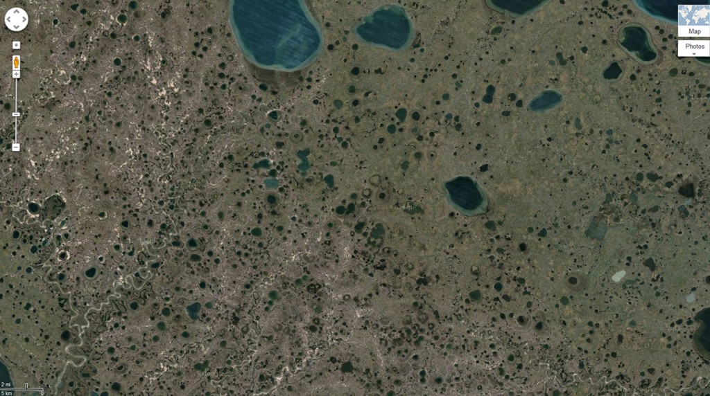
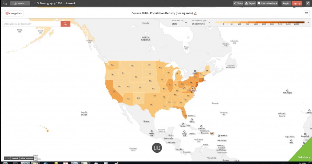
The web is rich in online GIS projects which allow us to explore research results in maps while controlling certain parameters in our browsers. For instance many projects are designed to tell a story with maps while allowing users to manipulate the time frame or the types of data mapped. In addition there are a number of GIS sites, called data portals, which allow users to search a map interface for geospatial data which they can use for creating their own online maps without resorting to cumbersome GIS software. Participants will be introduced to one such portal, Social Explorer®, a socio-economic database available to the Lafayette community through a subscription at Skillman Library. Following a map making exercise using this site we will explore other scholarly web GIS projects, focused largely on historical research. No GIS experience or knowledge is necessary to enjoy this casual exploration of online mapping. Windows laptops will be provided for all participants, but feel free to bring your own.

Lunch provided. Please RSVP by Friday October 24th  to John Clark, Data Visualization & GIS Librarian – clarkjh@lafayette.edu

Link to calendar: https://calendar.lafayette.edu/node/12257


GIS Workshop

Data Visualization & GIS Librarian John Clark will be offering a two part introductory class on GIS. Geographic Information Systems (GIS) are a powerful, yet easily accessible technology, used for analyzing and mapping information about the world around us.

In the first class participants will be given an introduction to basic geographic and information science concepts followed by a hands-on orientation to ArcGIS, a popular desktop GIS application available to the Lafayette community at Skillman Library and elsewhere on campus.

A second, optional workshop will be available the following week and will offer additional training using the ArcGIS application. You may take this first class as a complete, albeit brief, introduction to GIS or you may sign up for the series of two.

John will be offering two sections of this class.

Section A Section B
Introduction Weds. Oct. 1 Friday Oct. 3
Workshop (optional) Weds. Oct. 8 Friday Oct. 10

All four classes will be held 12:10 to 1pm in Room 003 Skillman Library.

Lunch will be provided.

To enroll RSVP John Clark at clarkjh@lafayette.edu.
Please indicate if you would like to take one or both Wednesday classes; or one or both of the Friday classes. 18 seats available in each.


For more information on starting a digital project with DSS or applying for an internship opportunity contact us at digital@lafayette.edu, or call (610) 330-5796.