DH in the Classroom: Dr. Mónica Salas-Landa on Archiving “Nature” (Digitally)

Dr. Mónica Salas-Landa, Assistant Professor of Anthropology

Dr. Mónica Salas-Landa used a Digital Humanities in the Classroom Grant to develop a class project in her Spring 2017 course “Anthropology & Sociology 201: Environment and Culture.” Read on for her reflections on the semester!

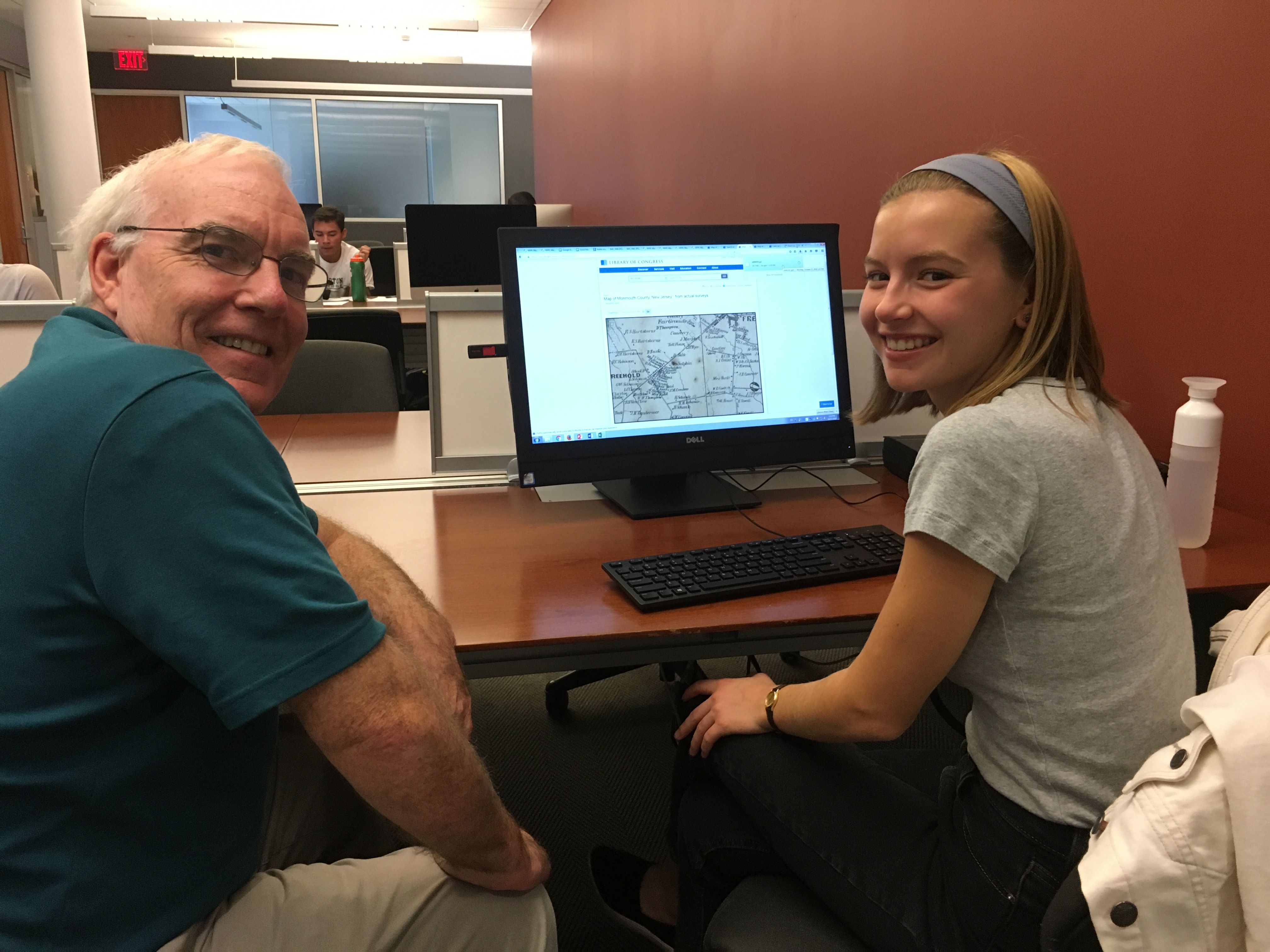
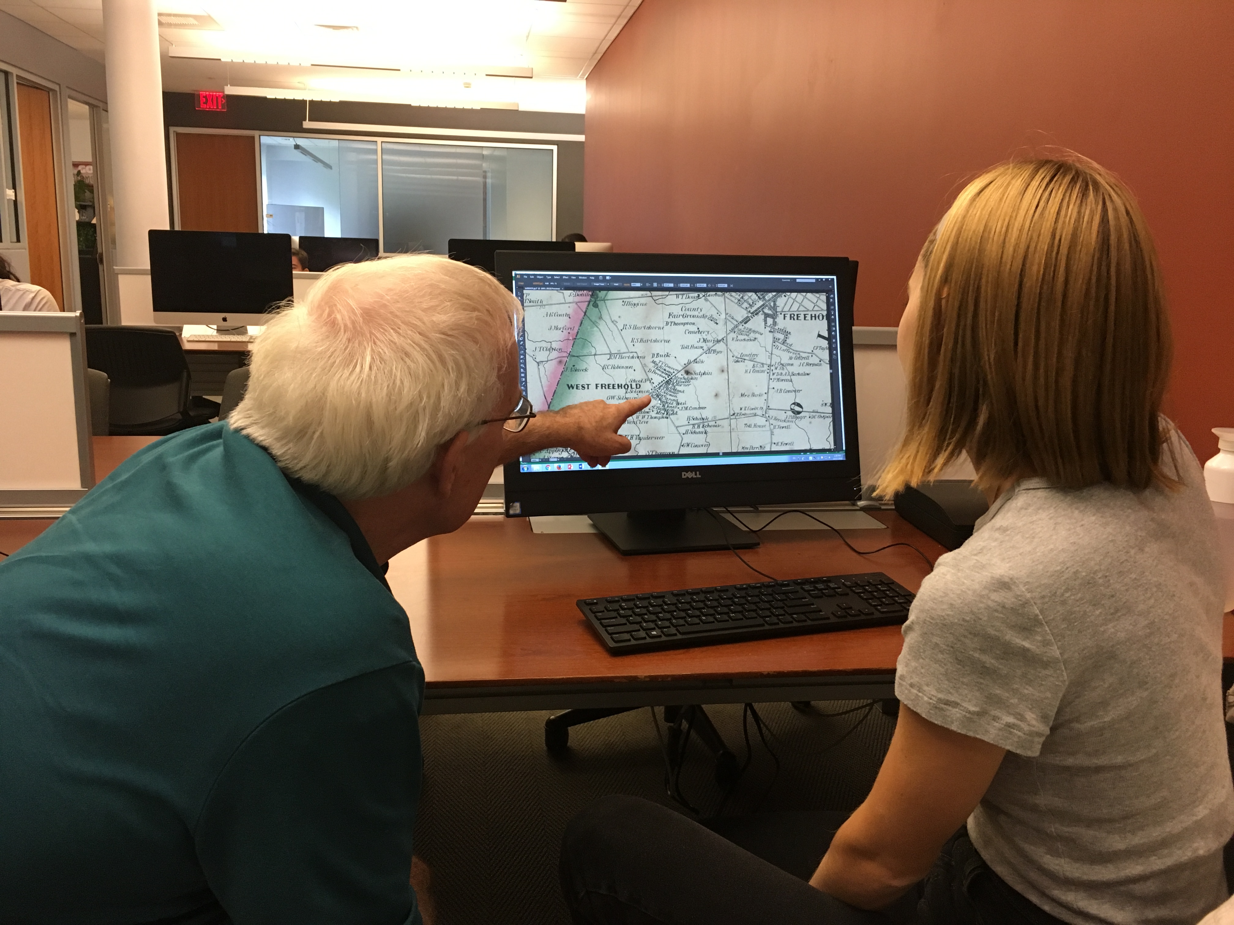
How can we understand the many ways in which people shape their environments and are, in turn, shaped by them? Although this basic question might be an expected centerpiece of a 200-level course titled “Environment and Culture,” my class last spring invited students to engage with this line of inquiry in the most direct and substantial way possible: across the semester, students developed research projects on a local landscape in Easton and made an argument about the nature-human dynamics that they encountered there. They drew on ethnographic and historical methods in order to analyze their chosen landscape and participate in relevant scholarly debates, which we discussed in class. The goal of this assignment, then, was not only for students to gain experience “reading” an actual landscape but also for them to develop a more robust understanding of how their own existence at this time and place is inextricably connected to other complex relationships between humans and their environment.

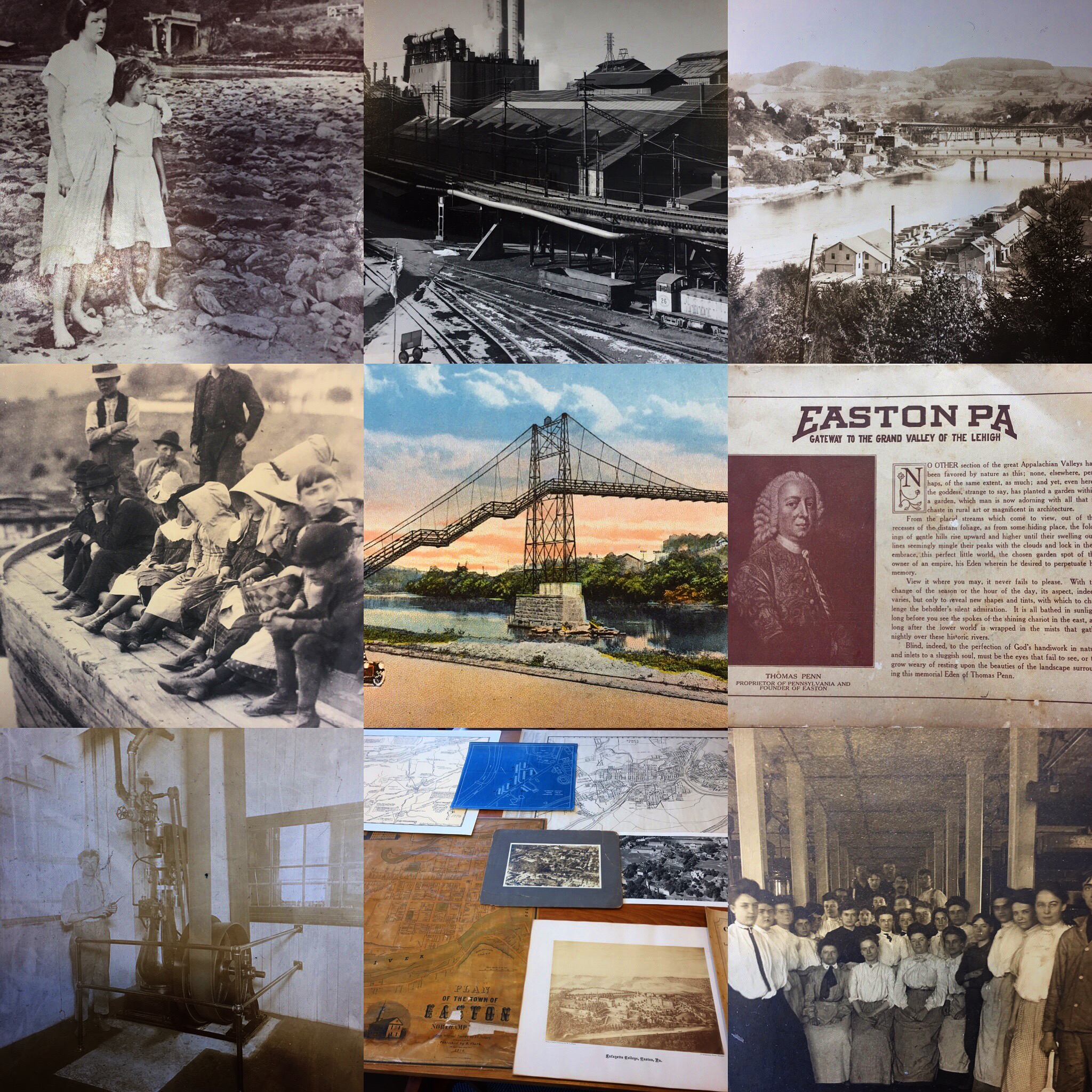
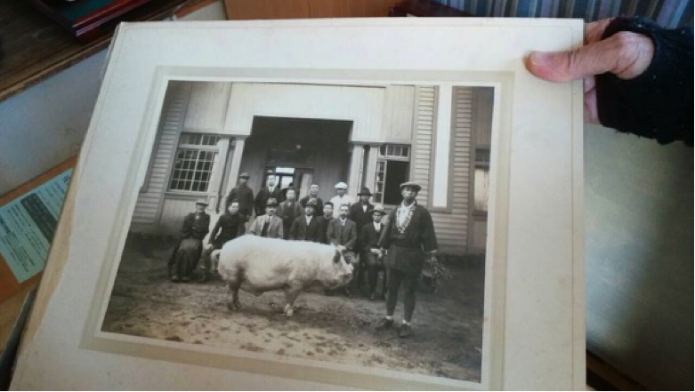
A variety of images students encountered in their primary source research for the class Omeka project

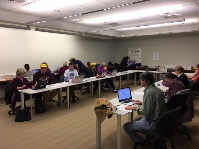
Students’ ethnographically and historically informed research, moreover, served as the basis for a collective class project: the development of a digital collection and exhibition based on material connected to everything from local dams, industrial parks, and cemeteries to roads, community parks, and food markets. During their research, each student collected, on the one hand, an image, sound recording, or video of their field site and related it to a piece of historical evidence, which they found in Lafayette Special Collections & College Archives or at the Easton Public Library. Using Omeka, a web-publishing platform for displaying archives, collections, and exhibitions, students catalogued their material, entered metadata, and created an exhibit page in which they further explored the relationship between concepts discussed in class and assemblies of items from our collection.

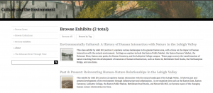
The A&S 201 Omeka site

By incorporating a digital humanities component into this class, I was able to introduce students to ethnographic and historical research of primary sources as well as the critical thinking involved in creating an archive. Through the selection, organization, cataloguing, and analysis of a myriad of documents, photographs, sound recordings, and videos of the Easton area, students connected their own research to wider theoretical issues about how representations of nature are constructed and disseminated.  The site, which remains a work in progress, can be viewed here.  

Further, drawing on the digital humanities in this course has also helped me to imagine ways of expanding and sharing my own research results on environmental degradation in oil zones in Mexico. I hope to use Omeka to develop a public “toxic archive” in which community members can document and record the harmful presences of oil and its infrastructure. In a context where the invisibility of toxicity works to mask or deny it, rendering its noxious effects visible is of utmost importance.


DH in the Classroom: Dr. Lindsay Soh

Dr. Lindsay Soh, Assistant Professor of Chemical and Biomolecular Engineering

Dr. Lindsay Soh used a Digital Humanities in the Classroom Grant to develop a class project in her Spring 2017 course “Chemical Engineering 370: Alternative Energy Sources.” In this course students are introduced to how to compare different energy technologies based on a number of different metrics. Read on for her reflections on the semester!

The idea of my Digital Humanities in the Classroom project was to communicate how an energy technology works to the general community and allow for greater understanding of the course metrics using data visualization. Specifically, the students’ project involved research into a chosen renewable energy technology.

The students first underwent literature-based research to understand the technology’s fundamentals. Next, they were asked to find and interpret data related to the technology in order to gain a deeper understanding of the feasibility of the energy source. The project consisted of a comprehensive report of the renewable energy technology that also incorporated how to communicate the findings with the general community. As such, the digital project included a visualization of the major findings that could be expounded from the data set and as related to the course metrics.

A data visualization created by Dr. Soh’s students on Tableau

Using the data analytics platform Tableau, students created public sites that provided a context and story for the visualization.   This resource is being made available to the Nurture Nature Center as a possible tool for their energy education program, and the public sites are also being posted on the my website.

Throughout the course, the concept of visualizing and interpreting data was discussed several times along with discussion and analysis. Furthermore, in collaboration with librarian Sarah Morris, the DH training consisted of several targeted sessions that sought to answer the following questions with the students

  1. Why is data visualization important?
  2. How to find and build data sets?
  3. How to use Tableau software for the final project visualization?

Upon reflection, I think that the integration of DH aspects into the course was largely successful. It has been my goal since coming to Lafayette College to provide students with the tools necessary to better communicate fact-based arguments. This project has served multiple purposes, allowing the students to explore a particular research question as well as develop ways to use data to explore a novel research question and communicate the findings.

The basic structure of the project worked well for these goals, however one shortcoming became apparent in the final products – the students were not able to utilize the data visualization software to its full abilities. For example, while the graphics that students produced were visually appealing, they were limited mostly to two variable comparisons; the beauty of data visualization is in the ability to elegantly intersect 3 or more variables to tell a different the of story with the data. I think that adding an extra deliverable would aid in this objective.

DSS Postdoctoral Fellow Michaela Kelly Reflects on International Conference Adventures

A view of the interior of Robarts Library, University of Toronto

NCC (the North American Coordinating Council on Japanese Library Resources) hosted a conference with the University of Toronto Libraries called Doing Digital Scholarship in Japanese Studies: Innovations and Challenges in mid-March. I was asked to give two short talks – one focusing on creating digital collections with students and partners, and one about using digital projects as a teaching tool in undergraduate learning.

Conference speakers included university librarians, faculty and CLIR postdoctoral fellows, describing their differing approaches to digital scholarship. Tokyo Metropolitan University professor Hidenori Watanave gave the keynote presentation, demonstrating a number of creative and interactive archive building projects he has been developing. Watanave’s projects group videos, photographs and data associated with people who experienced some of Japan’s most devastating disasters – the nuclear bombings of Hiroshima and Nagasaki and the battle of Okinawa in 1945, and the 2011 Eastern Japan Great Disasters. Visitors to Watanave’s archives can navigate maps to access the movement of people over time, watch video recordings of their stories or interact with other archival resources. Watanave is developing phone apps that use artificial reality (AR) to provide the same experience for visitors to these cities in real-time. Other digital scholarship sessions featured innovative map projects, local history work and a comprehensive scholarly image organization system.

The hand of the archivist and one photograph of many in the archive in Japan.

I also visited Japan, where I negotiated the building of a digital archive. The project aims to digitize tens of thousands of objects, photos and documents collected over a 70-year period. The collection features evidence of the pervasive military culture in Japan in the 1930s, but also preserves documentation on local history and governance, folklore, religion and festivals, family life and economic change. The digitization project will commence July 2017.

Last, I attended the Coalition for Networked Information (CNI) conference held in Albuquerque. Concurrent with the CNI conference, I attended the Council on Library and Information Resources (CLIR) mid-year conference, which included targeted sessions for fellows on grant writing, project updates, career mentoring, and the creation of small group projects. Time spent reconnecting with others in the cohort fostered collaboration on various aspects of our postdoctoral projects.

My thanks to the Andrew W. Mellon Foundation, NCC and CLIR for providing generous support for these learning opportunities.

Skillman Hosts Environmental Data Rescue Event

The Data Refuge logo.

On Sunday, April 2 from 1-8 p.m., Skillman hosted a Data Rescue in association with Data Refuge and the Environmental Data and Governance Initiative (EDGI).  The goal of the event was to contribute to a national effort to back up vulnerable data critical for research in the environmental sciences, including areas related to climate change and renewable energy development.  With Sunday’s event, Lafayette joined colleges across the country in a national effort to protect vulnerable climate date.  Recent and upcoming Data Rescues include events at Yale, UC-Davis, Harvard, and Haverford, among many other campuses.

The Lafayette College Data Rescue was an immense success, drawing 70 registered participants including students, faculty members, staff members, librarians, and Easton community members.  Lead coordinators of the event, Dr. Carolyn Buckley (Psychology) and Dr. Caleb Gallemore (International Affairs), explain the importance of the Data Rescue movement:

Data Rescue participants hard at work sorting environmental data to be backed up by the Internet Archive.

“Since 2008, EDGI, with the help of the Internet Archive (IA) and wayback machine, has been harvesting federal data at the end of every presidential term. This has become increasingly difficult with each election, as many data sets are too large for their automated web-crawler, or they include video or interactive data access that must be harvested manually. The amount of data to be harvested has increased from roughly 25 TB in 2012 to over 200 TB in 2016. For this reason, DataRefuge and others have been organizing Data Rescue events where concerned citizens assist in harvesting our most vulnerable data. This includes the contents of government web pages, as well as the scientific data that are only accessible through links on those pages.”

Student, librarian, and faculty “guides” at the Data Rescue wore yellow hats and brought a fantastic degree of fun, energy, and enthusiasm to the event. A huge thank you to student collaborators from the Lafayette Association for Computing Machinery, the Lafayette Society of Environmental Engineers and Scientists, and the Lafayette Environmental Awareness and Protection.  Special thanks also to the Provost’s Office, International Affairs, Psychology, and the team at Skillman Library.

East Asia Image Collection Adds 453 New Postcards

A postcard image among those recently added to the East Asia Image Collection.

The East Asia Image Collection (EAIC) has just added 453 picture postcards to its open-access database. These items range from “Yellow Peril” genre Russo-Japanese War cards from Europe to Japanese photo-journalism of the 1930s invasion of China. The collection also contains vistas of “Manchuria,” scenes from everyday life during wartime, and military-humor manga postcards. The EAIC is a collaboration between Paul D. Barclay, Associate Professor of History, and Digital Scholarship Services.  Visit our open-access archive digital archive including picture postcards, high-quality commercial prints, and colonial era picture books, among other unique materials.


Dr. Amir Sadovnik Presents on Digital Humanities in the Computer Science Classroom

Dr. Amir Sadovnik presents on his teaching as a Digital Humanities in the Classroom grant recipient.

When we talk about the digital humanities, often we’re thinking about how digital technologies can be applied to humanistic inquiry and pedagogy.  But Amir Sadovnik, Assistant Professor of Computer Science, is interested in how humanistic concerns and questions can enrich introductory studies in computer science.  On March 22, Dr. Sadovnik gave a presentation on his teaching as a grantee of the Skillman Library Digital Humanities in the Classroom program.

In Dr. Sadovnik’s “Intro to Computer Science” courses, students learn the essentials of programming.  Most students enter with no programming experience; over the course of the semester, they build the skills to program a tool to analyze data sets consisting of, for example, Lafayette College Yik-Yaks, or candidates’ Tweets from the 2016 presidential election.  Sadovnik explained that in his traditional introductory computer science course focused on digital media computing, students learned to develop and implement algorithms for final projects such as basic sound and image editors.  

A slide from Dr. Sadovnik’s presentation, outlining the goals of his DH in the Classroom project.

With his Digital Humanities in the Classroom grant, Sadovnik aimed to make the leap from digital media processing to analysis.  His teaching goals included: challenging students to construct more complex data structures in order to accommodate more complex data sets; providing students with the experience of working on a development team, as preparation for the workplace; and providing students with opportunities to work with data sets that interest them.  Dr. Sadovnik’s thinking was that if students could work with data that connect with their multidisciplinary research interests in history, political science, sociology, and other areas, they would connect more meaningfully with the programming tasks at hand.

Student Mike Van Ness presents a data visualization produced by the tool he programmed in Dr. Sadovnik’s class.

Student presenters who had taken Dr. Sadovnik’s courses also offered their reflections on the DH in the Classroom experience.  Shira Wein, Wassim Gharbi, and Mike Van Ness showcased their work from the class.  All of the students testified that working with complex, meaningful data enhanced their introduction to computer science.  Thank you very much to Dr. Sadovnik and his student co-presenters for sharing their important work!

GIS Librarian John Clark Offers Spring “Beware of Maps” Workshops

Historic map of the British Empire

Historic map of the British Empire

This spring, Data Visualization & GIS Librarian John Clark will offer two workshop opportunities for students and faculty to learn about critical cartography. Reading a map is trickier than you might expect. While maps casually present themselves as a visualization of reality, the truth is, all maps are imperfect models of natural and cultural features on the surface of the Earth. Reading a map involves understanding how a map maker has chosen to represent these features and, perhaps more importantly, what s(he) has left out. Join for a guided tour through a variety of different historical and contemporary maps as John explains some common principals used by cartographers. Participants will then have an opportunity to make a map using Social Explorer, an online mapping tool available to the Lafayette community through Skillman Library.

This event is being offered twice, Wednesday, February 1st and Friday, February 3rd, from 12:15pm to 1:00pm. Please RSVP to John Clark at clarkjh@lafayette.edu and indicate if you would like to attend the Wednesday or Friday event. Lunch provided.

Digital Scholarship Services Welcomes New Co-Director

Digital Library Developer James Griffin. Photo credit: Kylie Bailin

Co-Director of Digital Scholarship Services, James Griffin. Photo credit: Kylie Bailin

DSS recently welcomed James Griffin as the new co-Director for Research and Development.  James joined DSS in the position of Digital Library Developer in 2012, and the team at Skillman is thrilled that James agreed to step into this new role.  Motivated by an interest in digital preservation and scholarly communication, James is deeply involved in the application of open source technologies within libraries and archives.  James’s research interests focus on the semantic web.  He aspires to expand the usage of linked data beyond the domains of digital preservation and curation.  He is also intrigued by the potential for Development and Operations (DevOps) service management methodologies to increase durability and performance in technical infrastructure. 

Since joining DSS, James has worked on implementing Islandora, an open-source digital asset management framework.  He has also collaborated with faculty on the Swift Poems Project, the East Asia Image Collection, and the Easton Library Company Database Project.  Since 2015, James has been exploring how linked open data may be further integrated within the digital repository architecture for DSS.  He is Skillman Library’s liaison to the Project Hydra community.  In his new co-Director role, James will continue to collaborate on faculty projects and lead the migration of DSS digital assets to the Hydra repository solution.  James is excited to execute a vision for DSS anchored in the values of open-source collaboration and digital library preservation.  Congratulations, James!

DH Summer Scholars Impress at Bucknell Digital Humanities Conference

Guest-blogger Will Gordon ’17, one of the Skillman Library 2016 Digital Humanities Summer Scholars, reports on a successful presentation at the Bucknell University Digital Scholarship Conference

IMG_4150

From left to right: DH Summer Scholars Will Gordon, Tawfiq Alhamedi, Caroline Nawrocki, Mila Temnyalova, and Johnny Gossick

Last Friday, I piled into a van with four of my friends and fellow digital humanities scholars to drive to Bucknell University to present our undergraduate research and learn more about digital humanities.  Research and Instruction Librarian Sarah Morris, who is also the leader of the Digital Humanities Summer Scholar Program at Lafayette College, drove us to the Bucknell University Digital Scholarship Conference (#BUDSC16). Tawfiq Alhamedi ‘17, Caroline Nawrocki ‘18, Mila Temnyalova ‘18, Johnny Gossick ‘18, and I were all part of the summer program, in which we each designed, researched, and realized our projects.

IMG_4156Now it was time to present our projects to a crowd of undergraduates, graduate students and academics through a panel session and electronic posters. Dinner and the keynote speech from Assistant Professor of Sociology at Virginia Commonwealth University Tressie McMillan Cottom filled the first night. We learned about incorporating the digital humanities into a sociology graduate program, and saw ways to pursue these interests after graduating from Lafayette.

It was our turn to present the next day. Tawfiq, Caroline, Mila, and Sarah partnered up with members of Gettysburg College for a panel session on how to design a successful undergraduate digital humanities research program. Other attendees at the conference tweeted and commented on how impressed they were with Gettysburg’s and Lafayette’s programs.

IMG_4158

DH Summer Scholar Mila Temnyalova presents

Afterward, Saturday’s keynote speaker, UCLA professor Safiya Noble, spoke about biases in search engine algorithms at lunch and their effects on the way people perceive race and gender. Her talk illustrated the power of algorithms and information bias in society, and proved the importance of doing good digital scholarship.

As the day came to an end, Tawfiq, Caroline, Johnny and I took part in an electronic poster session while academics and other attendees drank wine, ate hors d’oeuvre, and wandered the room to listen to our presentations and others.

After packing up our things and going to a panel session Sunday morning, we began the journey back to Lafayette. Although, at times, scholarship can be a strange endeavor, we were excited about the opportunity to present our undergraduate research projects, and the positive feedback we received.


DSS Supports Original Undergraduate Research Using GIS

Which road systems were built along Native American trail ways, and why?  This research question, formulated by Molly Leech ’17 for her senior thesis in Anthropology and Sociology under the supervision of Professor Andrea Smith, represents the sort of historic geographic scholarly inquiry that John Clark, Data Visualization GIS Librarian, loves to support in his role at Skillman Library Digital Scholarship Services (DSS).  John offers a “Making Maps” workshop series at the Skillman Library that introduces students, faculty, and librarians to such tools as Google Maps, Social Explorer, and ArcGIS, a popular desktop GIS (Geographic Information Systems) application available to the Lafayette community at Skillman.  He also supports faculty and student research projects such as Molly’s.  While attending John’s “Making Maps” workshops to learn about digital tools she might use to explore her thesis topic geographically, Molly had the opportunity to share her research question with John, and she now works closely with him on a substantive GIS component for her thesis.

According to John, “maps and geographic understanding are relevant to nearly every major at the college–from Environmental Science to History to Civil Engineering and all points in between. Furthermore, mapping software has become simpler to use so that students can create their own geospatial data from spreadsheets or by extracting information from historic maps. This data can then used to make their own custom maps. I can assist students, whether it’s finding the right map online for a class assignment or assisting them with mapping software so that they can create maps from their own research.”

GIS Librarian John Clark works with Molly Leech '17

GIS Librarian John Clark (left) works with Molly Leech ’17 (right)

Molly explains that a geographic lens has been central to the development of her research. “My thesis retraces the history of two former Indian trails that intersect at the historic ‘Four Corners’ of Shrewsbury, New Jersey. By contextualizing maps from the late seventeenth century to present day with archival source material such as town histories and newspaper articles, I hope to reveal how these Indian trails transitioned to early colonial and present-day roads. This research allows me to explore the processes involved in the creation of a settler sense of belonging as well as the politics of street-naming and place-making.”

IMG_0073Molly emphasizes that the GIS component of her thesis is crucial to understanding her topic. “It’s not an easy job to try to locate these former Indian trails on the landscape–archival sources often use long-gone farms and homesteads as geographic points of reference.  Luckily, with the help of John Clark, I’ve been able to use archival maps from the same time period as my sources to retrace the Indian trails and then overlay present-day road maps onto this data. When I began my thesis research, I didn’t expect to be using GIS, but now, these compiled maps will be presented as part of my thesis to help re-conceptualize our surroundings and challenge the dominant narrative of Northeastern American colonial history.”

For Molly, her GIS exploration is thus central to her critical examination of settler colonial narratives in American history.  “There’s something to be said about the fact that we don’t tend to talk about the fact that many of the roads we drive on are former Indian trails. When we think of pre-colonial America, the dominant narrative is that settlers encountered an untamed wilderness; the idea of the intrepid pioneer is glorified. However, it makes complete sense that a settler nation would make use of the indigenous populations’ trails, and indeed start to settle along them. When we are conscious that we are driving on former Indian trails, we are reminded of our colonial history and we become more conscious of the longtime presence of Native Americans on the land.”

Are you interested in incorporating a mapping component in your research or teaching?  Contact John Clark at clarkjh@lafayette.edu.