 The image above is the River Shannon located in Ireland. It separates the West of Ireland from the wast and south. It is the largest river in Ireland. I have visited it multiple times during my yearly visits to Ireland. I would take walks along with my grandparents and uncles. It allows for many activities including fishing and kayaking. It is definitely a beautiful sight to see if you ever visit Ireland.
Month: September 2019 (Page 2 of 6)

This is a picture from the Ramapo River that is 30 miles long. It flows in souther New York and northern New Jersey. It flows from Rockland County to Ramapo, New York then to and Bergen County, New Jersey, where I experience it. This river is very popular for trout fishing. In this picture, the river is somewhat narrow, but at other parts, the river widens and that is where fly fishing is the most popular. The Ramapo River was originally inhabited by the Lenape tribe. Still today, some tribes are still located by the river and use its resources.
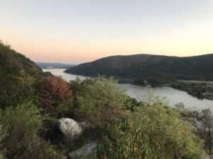
I took this photo from a scenic lookout on Bear Mountain. There is a beautiful drive from the Bear Mountain Bridge to the town of Peekskill, which you can see in the distance. On nice days I’ve seen many people bring their cars out on this stretch of road along the river, certainly a pleasant way of spending a day off.
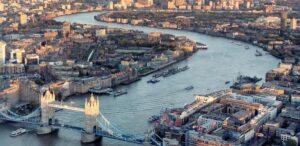
While doing some research about the River Thames for the Storymap project, I learned that it is named as one of the cleanest rivers in all of Europe. However, about 70 years ago, it was considered to be a lost cause due to the World War II bombings. Methane gas was able to seep into the river and the toxins were even able to destroy the propellers off boats. England was able to get its act together to clean up the river through the next couple of decades.
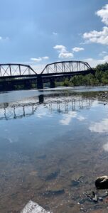
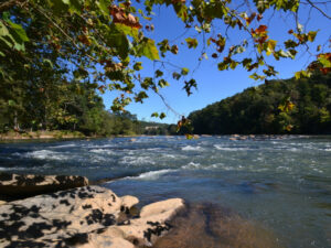
This is a picture of the the intersection of the Delaware River and the Lehigh River. I walked down to Scott Park and walked down to the steps to get a close up shot of the river with the bridge behind it. It is amazing to see the calmness of the river as you can see the clouds reflection of the surface.

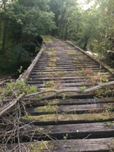
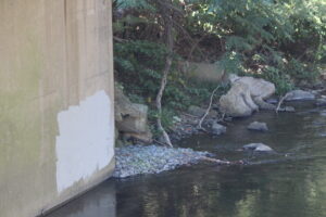
Yesterday afternoon, I had an adventure, or an exploration, along the Bushkill Creek. Started from the little dam down the hill of Lafayette College, I reached somewhere west side of Easton cemetery. For a while, as I walked along Bushkill drive and thought I lost the creek-I could only see the highway and could not find a way to access the creek again- an old wooden bridge suddenly came into my sight. I was so delighted by this discovery and decided to walk across the bridge. However, doing it was not easy because the bridge is mostly rotted. The gaps between the logs are very large, and the mosses make it very slippery to walk on. I was a little proud after walking across it successfully. When reached the other side of the river, I found a quite famous nature trail I didn’t know before. Walking along the trail back to school, I saw colorful fabrics that hang between tree branches, artistic display of pebble that form a circular labyrinth, and many graffiti-arts. Later, I knew from an exhibition board that the trial was named after Karl Stirner, a dedicated man who contribute tremendous artworks to Easton. It was a joyful exploration.
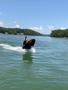
This picture was taken at the mouth of the Little Tennessee River in Tennessee. This area specifically is called lake Tellico, and it is a man made lake. During the Great Depression, building dams was part of FDR’s “new deal”, and the goal was to create more jobs and create hydroelectric power sources. During the 1930s, the Little Tennessee River was damed up, and as a result, Lake Tellico was formed. My Grandma lives on Lake Tellico, and my family and I visit her every summer and jet ski on the lake!
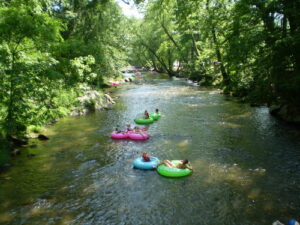
The Chattahoochee is one of many rivers in Georgia. I grew up in Gwinnett County, which lies right next to the river. The Chattahoochee supplies Metro Atlanta with 70% of its drinking water, and works as a natural border between Georgia, Alabama, and some of Florida. It also acts as a border for many counties in Georgia. When I was younger, every summer, my family and I used to make trips up to Helen, Georgia to go tubing in the Chattahoochee.
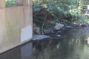
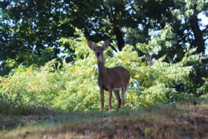
As I walked by Bushkill Creek, I noticed that the graffiti that had once existed beside it was covered up. I’ve always been a fan of graffiti, and wish there were more public places where it would be legal and accepted. This wall would be significantly more attractive with the help of artists from Easton. The creek would create a pleasant atmosphere for their work to be displayed. I truly believe that leaving this wall blank and covering up any graffiti on it is a missed opportunity. Perhaps the deer I spotted by the creek was also saddened by this development.
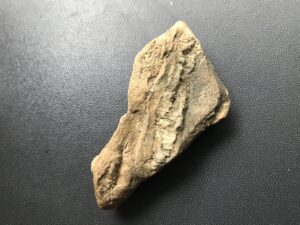
I found this rock by the Delaware river on a hike for Geology 100. There is a line in the rock that almost looks like it’s splitting apart. This line is called a tension gash and is filled with crystal. This small rock gives us hints into the history of the Delaware river millions of years ago. Once there was no river here, instead it was a mountain or large hill. Seismic activity occurred, causing cracks to form in the rock. The water got into the cracks and over a very long time of freezing, thus expanding, and thawing the crack got wider and wider until the river busted this mountain open. The line on this rock shows the same type of seismic activity that occurred all of those years ago. I’ll talk more about it in my GORP next Tuesday.