The West Side Highway

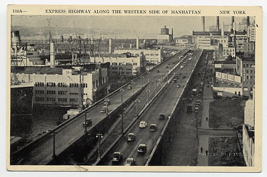
The West Side Highway Viaduct before it was demolished in 1989.

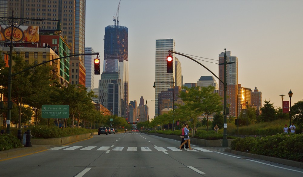
The current West Side highway is shown in the header image on the top of this page.  It is now a grand boulevard lined with trees and bikeways making it one of the most aesthetically pleasing streets in New York City.  Of course, by its name it lies on the west side of Manhattan and is a major thoroughfare on that side of town.

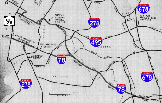
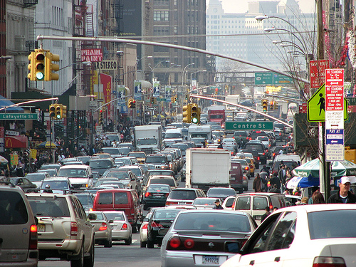
However, the West Side Highway was not always like that.  It was once a limited access viaduct that stretched from the World Trade Center to the Bronx.  New York City on the west side was primarily an industrial area and having the viaduct proved valuable for business and commuters.  It was an expressway that bypassed all the congestion of New York City traffic and was praised for just that.

During the late 60s and 70s maintenance on the viaduct was considerably lacking.  New York City as like many other cities was going through rough economic times and could not afford the upkeep of its highways.  It came to a point that the west side viaduct was so structurally deficient that a cement truck on its way to fix the road deck collapsed a section of the structure in 1973.  How ironic.

The elevated highway was immediately shutdown.  Instead of fixing the problem, NYCDOT   did not want to invest the $88 million to repair it.  The structure remained standing for sixteen years before it was finally demolished in 1989.  However, there were plans in 1977 for the structure to be rebuilt, but drivers found other routes to get to where they need to go.  City officials did not find the economic and societal costs worth it.  Officials instead made it into a grand boulevard in 1999 which made the area much nicer.

The new open area on the water front has revitalized the west side of NYC and has benefited generations of citizens.  There used to be an rusting and decaying structure that was the blight of the west side and people did anything to avoid it.  Now people, want to live there and walk along the waterfront.  Old factory buildings were restored to offer living spaces.  The removal of the west side highway has benefited NYC in so many ways and I believe other cities in this country should take this as a good example and apply it to highways that cut off their waterfront.

(http://www.nycroads.com/roads/west-side/)

Interstate 78 in NYC

When the United States was going through the highway boom in the 50s and 60s, there were a lot of planned routes through every major city.  Most came to fruition, but many were not constructed due to community opposition or lack of funding.  Interstate 78 in NYC is one of those unbuilt routes.  It currently ends in New Jersey at the Holland Tunnel entrance, but there were plans for it to go through the tunnel, through Manhattan via the Lower Manhattan Expressway (unbuilt), over the Williamsburg Bridge to Brooklyn, via the Bushwich Expressway (Unbuilt) to Kennedy Airport, then north to the Bronx. The map above shows part of the route.

I actually think about, how NYC would be different if all the routes that were planned were actually built.  It would have been a very different place.  These additional routes would have eased congestion on the road network, but destroy many communities.  Furthermore, if you build new roads it creates an induced demand where more people than before would drive.  So these new roads would have eventually become congested anyway.

Canal Street is the arterial street in Manhattan that drivers take to drive between the Holland Tunnel and the Williamsburg & Manhattan Bridges. These drivers exited highways in New Jersey and Brooklyn and have no choice, but drive on local streets.

But is it better to have congestion on the highways and not on local streets?  I think so.  This is how it is now in NYC.  I-78 would have traveled in lower Manhattan connecting the Williamsburg Bridge to the Holland Tunnel.  That is a major corridor for drivers to travel between Long Island and New Jersey, but there is no highway link between them.  Currently, vehicles crowd the street, sometimes taking over an hour to travel one mile.  I cannot imagine that being good for air quality.

The original plans for the I-78 Lower Manhattan Expressway called for an elevated highway for the majority of its route which would require a lot of condemning of homes.  That is one of the major reasons to why it was not constructed.  It would have been an eyesore like some of NYC’s current elevated highways.

So today NYC is plagued with crippling congestion in its downtown area.  I think the only feasible solution that people would support is a underground expressway connecting the bridge and the tunnel.  I can see that happening one day because we are delaying a problem that continues to get worse. It would be extraordinarily difficult, but I find it cool to just picture such an achievement and driving through it.

The unbuilt Lower Manhattan Expressway

(http://www.nycroads.com/roads/bushwick/)

(http://www.nycroads.com/roads/clearview/)

(http://www.nycroads.com/roads/lower-manhattan/)

Second Avenue Subway in NYC

The light blue line is the Second Avenue Subway Line that is now under construction. The faded green line just to the left is the existing line that will be relieved. The yellow line is an existing train line that will expand its service on the northern portion of the Second Avenue Line.

Stopped completely twice due to budgetary problems and taking over 70 years to complete, the Second Avenue Subway Line on the east side of Manhattan is finally coming to fruition.  It is designed to relieve congestion on the Lexington Avenue Line only three avenues to the west and provide more access on the east side.  It will finally be completed in April of 2018.

However, there is something on my mind that bothers me.  The existing line just three avenues west has a four track configuration while the second avenue line has a two track configuration (Refer to Figure 1).  If I want to get uptown or downtown the fastest possible, I am more likely going to take the existing line then the new one because of the express trains.

I do understand that it will provided more access on the east side and that is a great thing for the future growth along the east side.  I only wish that they would have continued with the four track plan that has express stations as originally proposed, but due to the overwhelming cost, it was cancelled.

(http://secondavenuesagas.com/2011/09/27/east-side-access-completion-date-postponed-to-2018/)