New Hudson River Crossing in New York City? Part III – Why No New Hudson River Crossing to Manhattan?

I have written a comprehensive report for my Sustainable Transportation course at Lafayette College that answers the question on why we have not built a new crossing linking Manhattan and New Jersey.  This was a project assigned to our class addressing transportation issues in the United States.  Being from New York City, I chose this topic because I wanted to know why I have to wait in traffic for up to an hour on the approaches to any of the existing crossings.  What I have discovered and written explains the social, political and economic attitudes that stagnated the highway growth in the New York Metro Area after the expansion of the George Washington Bridge.  It will also give insight on the future of crossing the Hudson River.  The PowerPoint associated with it will be posted soon.

“Smart Highways” will glow in the dark, plus a lot more

Glow-in-the-Dark Pavement Markings which would improve vision and safety at night.

What if a highway had luminescent markings that absorbed sunlight during the day and can shine during the night.  What if a highway had little pinwheels on the side of the road that generated electricity due to drafts by passing cars.  What if a highway had a lane that charged electric vehicles that drive in a designated lane.  These are only some the futuristic concepts made by Studio Roosegaarde and Heijmans Infrastructure, a Dutch design firm.

Electric Vehicle Charging Lane which will encourage people to leave the combustion engine automobiles.

They say that this is the future of roads instead of just sitting their doing nothing.  However,  I cannot help, but think that the cost alone will be a huge disadvantage as well as the extreme maintenance needed.  I would love to see these concepts implemented one day.  Check out this linkfor more future plans for roads.


Source: http://www.gizmag.com/smart-highways/24836/

Electricity Generating Pinwheels will generate electricity and light the road in front of the vehicle at night.


Bayonne Bridge Reconstruction

The Bayonne Bridge

The Bayonne Bridge is the fourth-longest steel arch bridge in the world, and was the longest in the world at the time of its completion. It connects BayonneNew Jersey with Staten IslandNew York, spanning the Kill Van Kull which is a very active route for cargo ships to ports in New Jersey.  Its clearance is 151 ft, but that is no longer large enough for the new cargo ships that have increased there size and height to almost 200 ft.

In order to tackle this problem the Port Authority of New York & New Jersey (PANYNJ) has approved plans to raise the elevation of the bridge to 215 ft without tearing down the bridge.  It is a national Historic Civil Engineering Landmark, so the Port Authority did not have much of a choice.  It is quite fascinating in the video on how they would complete such an endeavor.

Not only will the bridge be raised to secure continued shipping operations, but additional benefits for the public would also be created.  The existing bridge has a 6 ft walkway, 10 ft wide travel lanes (two in each direction), with neither shoulders nor a median divider.  After the project is completed there will be 12 ft wide travel lanes, 6.5 ft right-hand shoulders, and a median divider for improved safety and to extend the life of the bridge.  Furthermore, a new toll gantry will be installed, allowing for quicker travel over the bridge and there will be a 12 ft wide bikeway/walkway for the entire length of the bridge with access ramps replacing existing stairs.

Source: http://www.panynj.gov/bayonnebridge/

Redeveloping Communities Bisected by Expressways

A submerged section of the Brooklyn Queens Expressway in Brooklyn, New York.

In the 1950s, the construction of elevated and sunken highways marred many cities in the name of progress and the almighty automobile.  The Brooklyn Queens Expressway in New York City is a great example.  The picture on the right shows a portion of it in a trench and it is an eyesore that splits a neighborhood in half.  But what if we could bring the community back together by incorporating a design that would cover it and provide additional green spaces while also enhancing the bicycle and pedestrian environment?

Some options were unveiled by artists that really should be considered by the NYSDOT to bring a community back together.  Some of those options are shown below.  Cities across the country should incorporate these designs for redeveloping areas that were mauled during the construction of these expressways.

Artist rendition of creating a trellis Structure over the trenched rows which includes Photo-voltaic panels that generate revenue for the City. Photo-voltaic array could earn the city $USD312,500 per year through energy generation.

Artist rendition of maximum green. It creates a green streetscape with traffic calming, tree plantings, water sensitive design with the option for green screens/artistic fences.

Artist rendition of creating “green machine” bridges equipped with greenscreen or acoustic panels, PV, and decorative lighting, with the option of adding treatments from the ‘Maximum Green’ concept.

Source 1: http://buildipedia.com/in-studio/urban-planning/fix-the-ditch-enhancing-the-brooklyn-queens-expressway

Source 2: http://worldlandscapearchitect.com/starr-whitehouse-unveil-brooklyn-queens-expressway-options/#.UIh2Q51lR4d

Cutting Off of Waterfronts

There are many limited access highways across the country that cut of the water fronts in cities.  Most of these highways were built along waterfronts because it was cheaper.  There were not as many building to demolish or overpasses to create.  The thought process of highway planners during the United States highway boom was to build the most cost-efficient highway.  As a result, society is now paying for its devastating impacts.

When you lose a waterfront, you lose vitality.  People are less inclined to go to these areas if access to it is difficult.  When you have a highway that separates the land from the water, it makes it more difficult for people get to it.  And when you don’t have an influx of people in areas, the area decays and becomes run down.  This is what happened to many cities across the nation.

There are solutions to such problems that some cities have done to beautify and encourage people to go to waterfronts that have previously been cut off by highways.  Some cities have buried the highway completely granting full access to the water.  Others, have removed the highway and created grand boulevards lined with trees and shrubs with many stop lights for pedestrians to walk over.   And there are cities that have reinvigorated areas by taking in to account the landscape the highway goes through and building many bridges across.

The most expensive solution is burying the highway and the cheapest is to create a boulevard.  Cities should think about how to revitalize these areas that are cut off by enacting these solutions.  New York City did it on its west side and will benefit many generations in the future.  Look at my blog post about the West Side Highway.  It goes into a little more detail.


The West Side Highway

The West Side Highway Viaduct before it was demolished in 1989.

The current West Side highway is shown in the header image on the top of this page.  It is now a grand boulevard lined with trees and bikeways making it one of the most aesthetically pleasing streets in New York City.  Of course, by its name it lies on the west side of Manhattan and is a major thoroughfare on that side of town.

However, the West Side Highway was not always like that.  It was once a limited access viaduct that stretched from the World Trade Center to the Bronx.  New York City on the west side was primarily an industrial area and having the viaduct proved valuable for business and commuters.  It was an expressway that bypassed all the congestion of New York City traffic and was praised for just that.

During the late 60s and 70s maintenance on the viaduct was considerably lacking.  New York City as like many other cities was going through rough economic times and could not afford the upkeep of its highways.  It came to a point that the west side viaduct was so structurally deficient that a cement truck on its way to fix the road deck collapsed a section of the structure in 1973.  How ironic.

The elevated highway was immediately shutdown.  Instead of fixing the problem, NYCDOT   did not want to invest the $88 million to repair it.  The structure remained standing for sixteen years before it was finally demolished in 1989.  However, there were plans in 1977 for the structure to be rebuilt, but drivers found other routes to get to where they need to go.  City officials did not find the economic and societal costs worth it.  Officials instead made it into a grand boulevard in 1999 which made the area much nicer.

The new open area on the water front has revitalized the west side of NYC and has benefited generations of citizens.  There used to be an rusting and decaying structure that was the blight of the west side and people did anything to avoid it.  Now people, want to live there and walk along the waterfront.  Old factory buildings were restored to offer living spaces.  The removal of the west side highway has benefited NYC in so many ways and I believe other cities in this country should take this as a good example and apply it to highways that cut off their waterfront.

(http://www.nycroads.com/roads/west-side/)

Interstate 78 in NYC

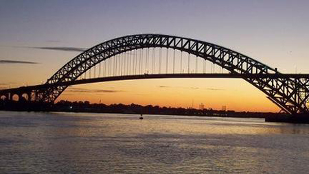
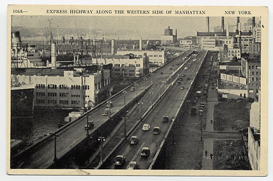
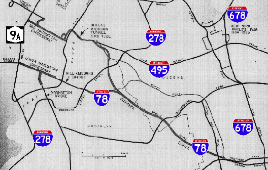
When the United States was going through the highway boom in the 50s and 60s, there were a lot of planned routes through every major city.  Most came to fruition, but many were not constructed due to community opposition or lack of funding.  Interstate 78 in NYC is one of those unbuilt routes.  It currently ends in New Jersey at the Holland Tunnel entrance, but there were plans for it to go through the tunnel, through Manhattan via the Lower Manhattan Expressway (unbuilt), over the Williamsburg Bridge to Brooklyn, via the Bushwich Expressway (Unbuilt) to Kennedy Airport, then north to the Bronx. The map above shows part of the route.

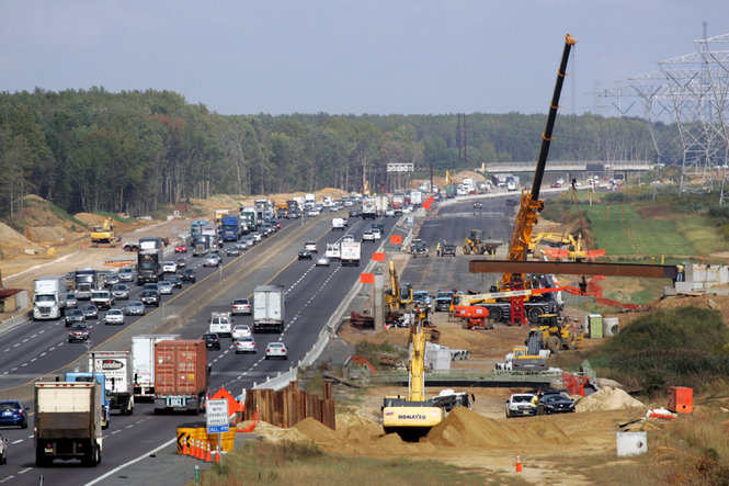
I actually think about, how NYC would be different if all the routes that were planned were actually built.  It would have been a very different place.  These additional routes would have eased congestion on the road network, but destroy many communities.  Furthermore, if you build new roads it creates an induced demand where more people than before would drive.  So these new roads would have eventually become congested anyway.

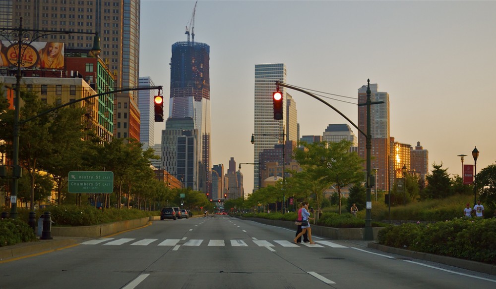
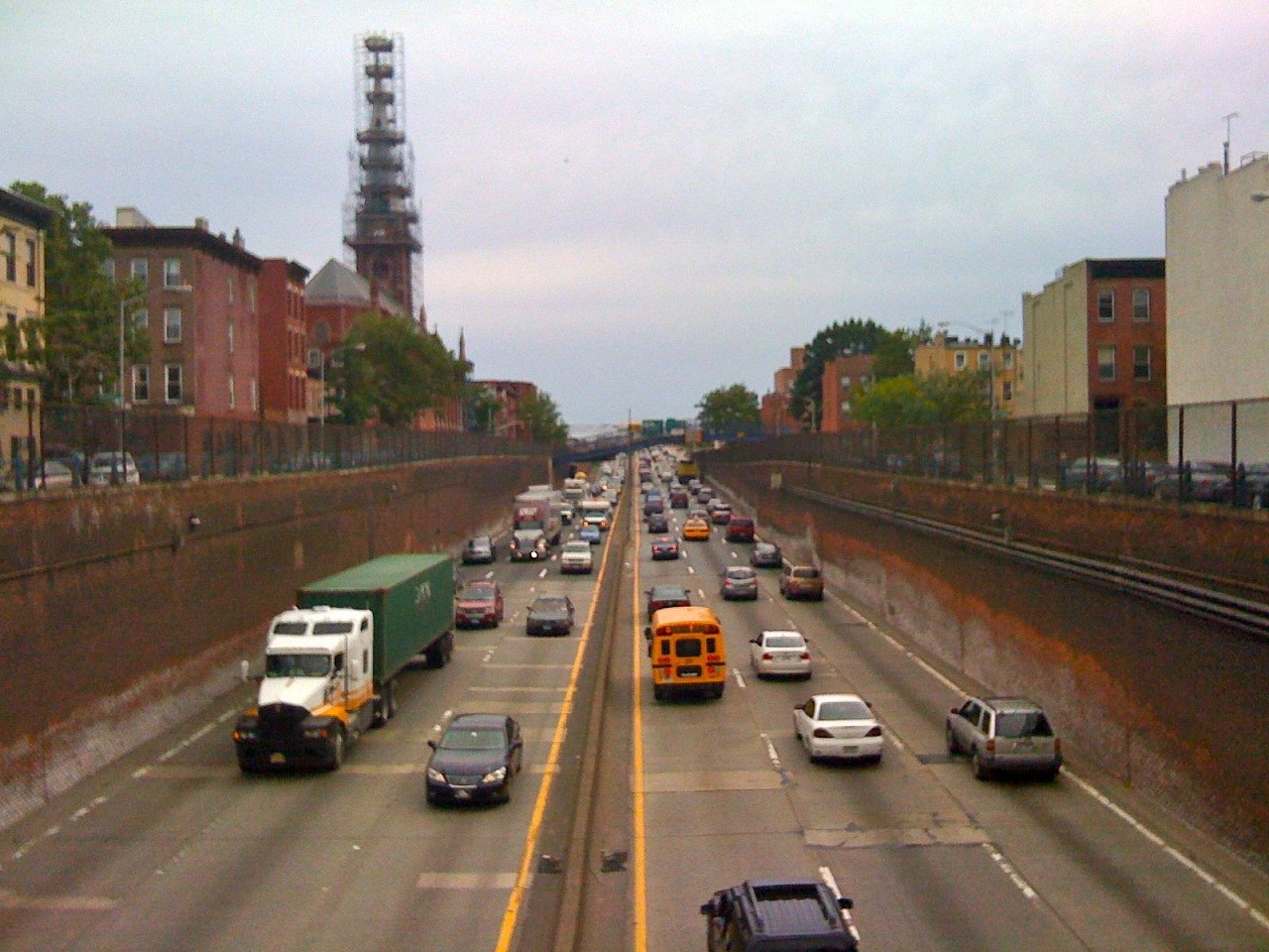
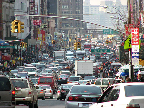
Canal Street is the arterial street in Manhattan that drivers take to drive between the Holland Tunnel and the Williamsburg & Manhattan Bridges. These drivers exited highways in New Jersey and Brooklyn and have no choice, but drive on local streets.

But is it better to have congestion on the highways and not on local streets?  I think so.  This is how it is now in NYC.  I-78 would have traveled in lower Manhattan connecting the Williamsburg Bridge to the Holland Tunnel.  That is a major corridor for drivers to travel between Long Island and New Jersey, but there is no highway link between them.  Currently, vehicles crowd the street, sometimes taking over an hour to travel one mile.  I cannot imagine that being good for air quality.

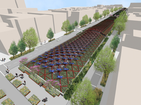
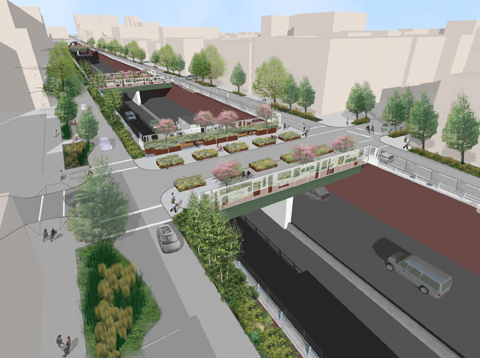
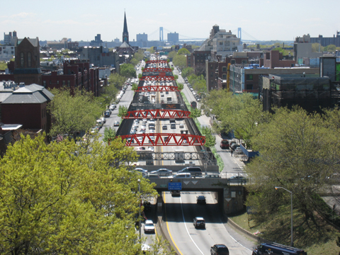
The original plans for the I-78 Lower Manhattan Expressway called for an elevated highway for the majority of its route which would require a lot of condemning of homes.  That is one of the major reasons to why it was not constructed.  It would have been an eyesore like some of NYC’s current elevated highways.

So today NYC is plagued with crippling congestion in its downtown area.  I think the only feasible solution that people would support is a underground expressway connecting the bridge and the tunnel.  I can see that happening one day because we are delaying a problem that continues to get worse. It would be extraordinarily difficult, but I find it cool to just picture such an achievement and driving through it.

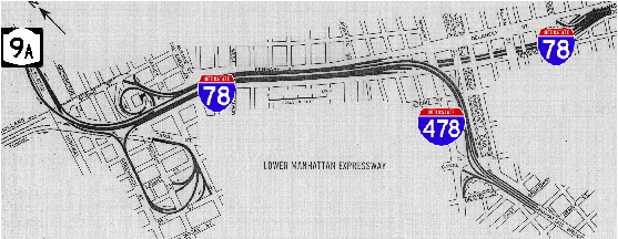
The unbuilt Lower Manhattan Expressway

(http://www.nycroads.com/roads/bushwick/)

(http://www.nycroads.com/roads/clearview/)

(http://www.nycroads.com/roads/lower-manhattan/)

Should Highways Grow as Population Grows?

Should are highway infrastructure be expanded as our population grows?  This is a question that has two answers which depend on the time period.  The answer was yes post World War II and when the President Eisenhower signed the Interstate Act of 1956.  Then people started to realize the adverse effects of highway building and the answer became no.  The highway boom of the 40s, 50s and 60s vanished.

I think that highways as well as every other form of transportation should grow as  population grows.  If a system becomes out dated we need to improve or expand it. It is vital to further our economic development that are transportation systems are up to par with demand.  

Widening of the New Jersey Turnpike.

The New Jersey Turnpike Authority is leading the way with their Widening Program.  The NJ Turnpike will be widened between Interchange 6 in Mansfield Township, Burlington County and Interchange 9 in East Brunswick Township, Middlesex County. The roadway will be widened to 12 lanes with major modifications constructed at four interchanges.  Construction is planned to commence during 2009 with project completion in late 2014.  (http://www.njturnpikewidening.com/)

The authority understands that the turnpike is vital to the economic growth of New Jersey and that demand on the road is increasing.  This project will reduce congestion and give drivers a better driving experience.

I understand that this is controversial and that there are many problems with my above statements. I look forward to anyone’s remarks on this topic.  Should the Turnpike Authority widen their road?  Should we do it for any road?