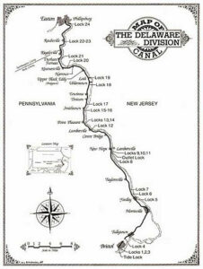
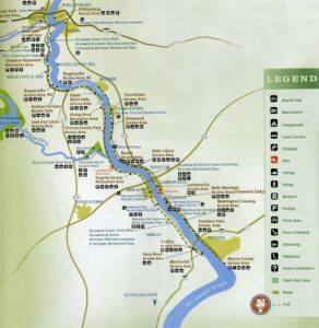
These two maps are of the Delaware canal that begins in Easton. For Tim’s and my StoryMap project we are researching the canal. I thought it would be great to show some of our progress and what you can do with the canal. The map on the left is a historic map with the locations of all of the locks. This is the path the coal carrying, mule pulled, boats would take to get to Easton. The map on the right is an updated map with all of the towns that the canal passes through on both sides of the river. It’s an amazing trip to take with plenty of good restaurants along the way if you have a bike and some free time.
The map on the right is perfect guidance for a trip along Delaware Canal. It’s such a pity that this website can not zoom in on the map. Do you have a reference for it?