Here I will discuss Ocean Islands Systems. However, I will be analyzing the volcanic system called the Canary Islands.
Tectonic Setting
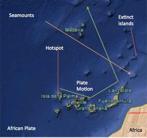
The Canary Islands are located on the African Plate just off of the coast of Morocco. These Islands formed on the oceanic part of the African plate in the Atlantic Ocean. The motion of the plate is eastward and then to the north. This is seen by the trail of sea mounts. Volcanism in this area is most likely due to the Increased heat at this one point on the African Plate.
There are five islands above the surface. They are : Isla de Palma, Santa Cruz de Tenerife, Las Palmas de Grand Canary, Fuerteventura, Lanzarote. The only recently active volcano is located on Isla de Palma. The islands that are found in these locations are Strato volcanoes. The motion of the plate is eastward and then to the north. This is seen by the trail of sea mounts.
This image illustrates the whole of the Canary Island chain. I have important features noted on the map itself. The plate motion is eastward and northward. This is indicated by the seamounts trailing off to the north.
Notable Volcano
One notable Volano in the canary islands is La Palma. This volcano has been relatively quiet in recent history as the last volcanic eruption was from October 26 to November 18th in 1071. According to the Global Volcanism Program there have been 13 recorded eruptions in the Holocene. However, none of these eruptions are considered to be historic.
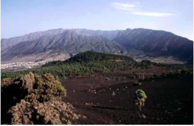
An interesting volcanic landform is the Cumbre Vieja. It is the most active area of the island and had the eruption in 1971. It contains many active and inactive craters and fissures. It is wildly unstable as seen in the image below part of the ridge collapsed.
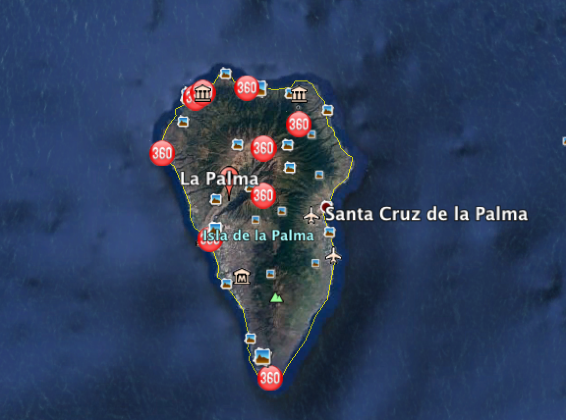
This is an image of the Cumbre Vieja. The valley to the right of the image is where part of the ridge collapsed. This imaage is from the Volcano Program’s website.Here is a Google Earth image of the Santa Cruz de la Palma. As you can see, La Palma volcano makes up the majority of the northern part of the island.
Geochemistry
Here I am going to discuss the specific geochemistry of the Canary Islands.
Harker Diagrams
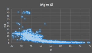
This plot indicates the amount of magnesium in the magma. It highlights its compatibility as you can see the decrease in the amount of magnesium in the magma as the amount of silica increases. This is due to the size of the magnesium cation and its high charge.
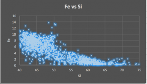
This plot indicates the compatibility of iron as the magma evolves.
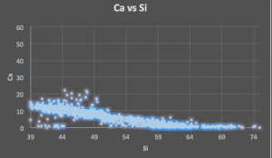
This indicates the compatibility of the calcium due to its small size and charge. It acts similarly to that of Iron.
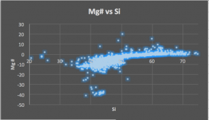
The magnesium number represents the decrease of magnesium in regards to the decrease of iron. It highlight the decrease of both of these elements and how little there was to begin with.
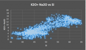
This indicates the incompatibility of the alkalies the alkalies. As more magma begins to crystalize. The higher presence of these larger elements highlights their incompatibility.
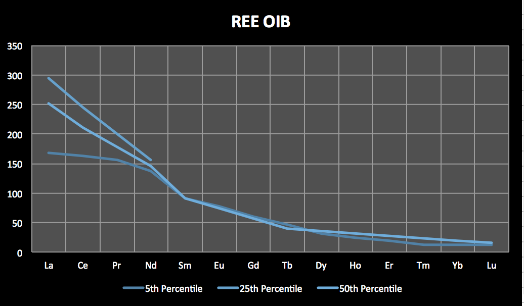
REE/Chondrite
This REE/Chondrite illustrates the highlights the trend of these minerals at an Ocean Island. In oceanic basalt, there tends to be a higher amount of the Light Rare Earth Elements (LREES) in comparison to the Heavy Rare Earth Elements (HREES). The LREEs are more common in source rock that has not been as depleted. As the source rock is heated, the LREEs leave the source rock because they are less comparable than the HREEs. This accounts for the spike in LEEs and the low amount of HREEs in the REE diagram. I chose data from the 5th, 25th and 50th percentiles to illustrate this curve.
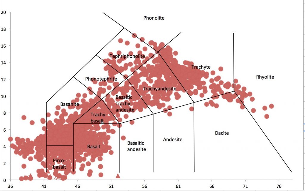
TSA Plot
This image illustrates the types of rocks that can be achieved by solidifying the magma present at the Canary Islands. There is a broader range of possibilities due to the type of magma generated. However, this could be indicative of the volcanic system bringing to move on to form a new island as it looks as if there is an increase in the amount of rhyolitic magma.
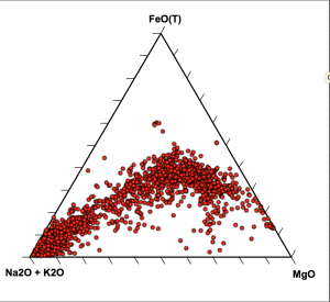
AFM Plot
This image represents the variation of the volcanics at the ocean island system. There is a large variation in this magma. It ranges from tholeiitic and calc-alkaline. This illustrates the life cycle of the volcanoes in this region. There is a trend towards the calc-alkaline variety as the volcano goes though its life cycle. Calc- Alkaline magma is higher in Sodium and Potassium.
The magma at the Canary Islands appears to range from calc-alkaline and tholeiitic. This illustrates the life cycle of the volcanic island and could indicate that the hot spot is moving and a new volcanic island might be forming,
Rocks and Thin Sections
Extrusive
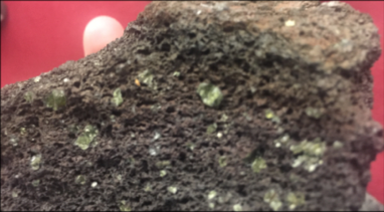
Hand Sample
Hand Sample LMP
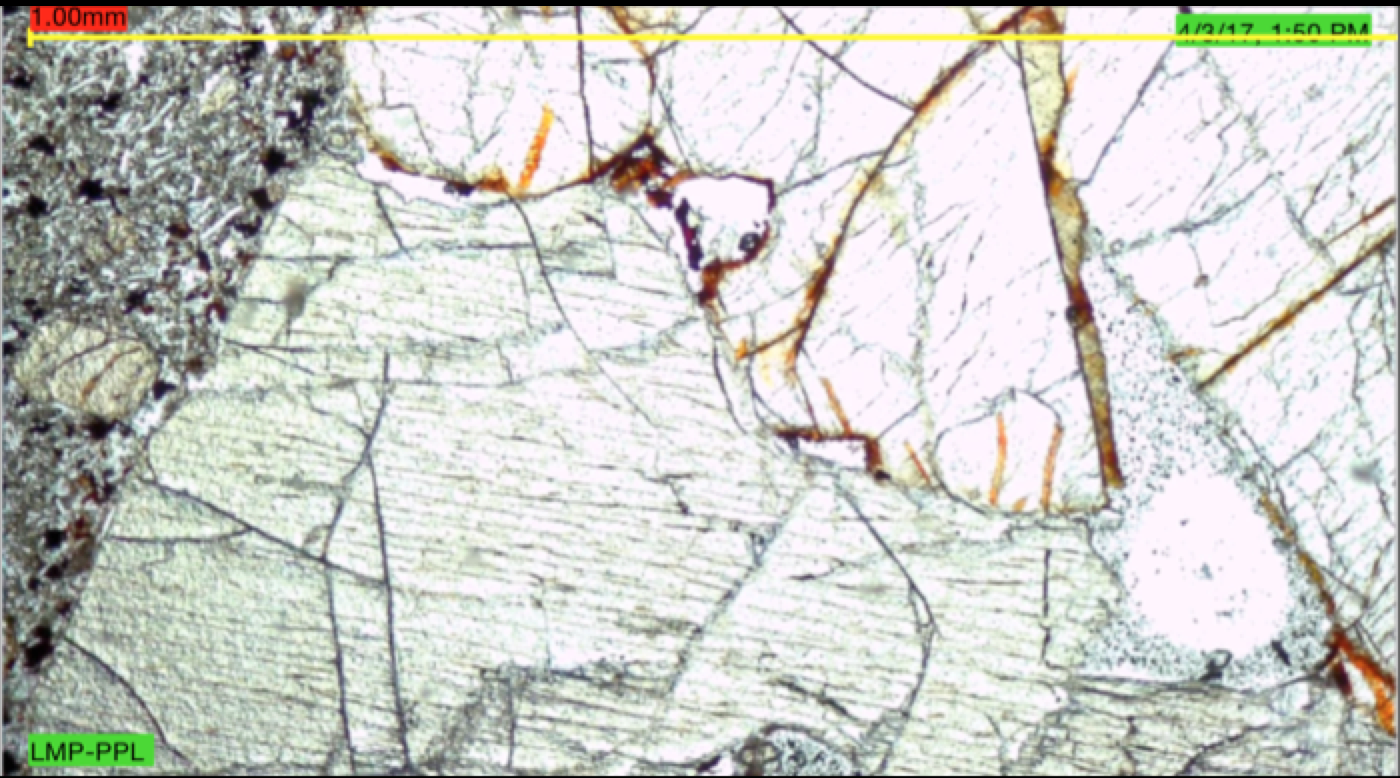
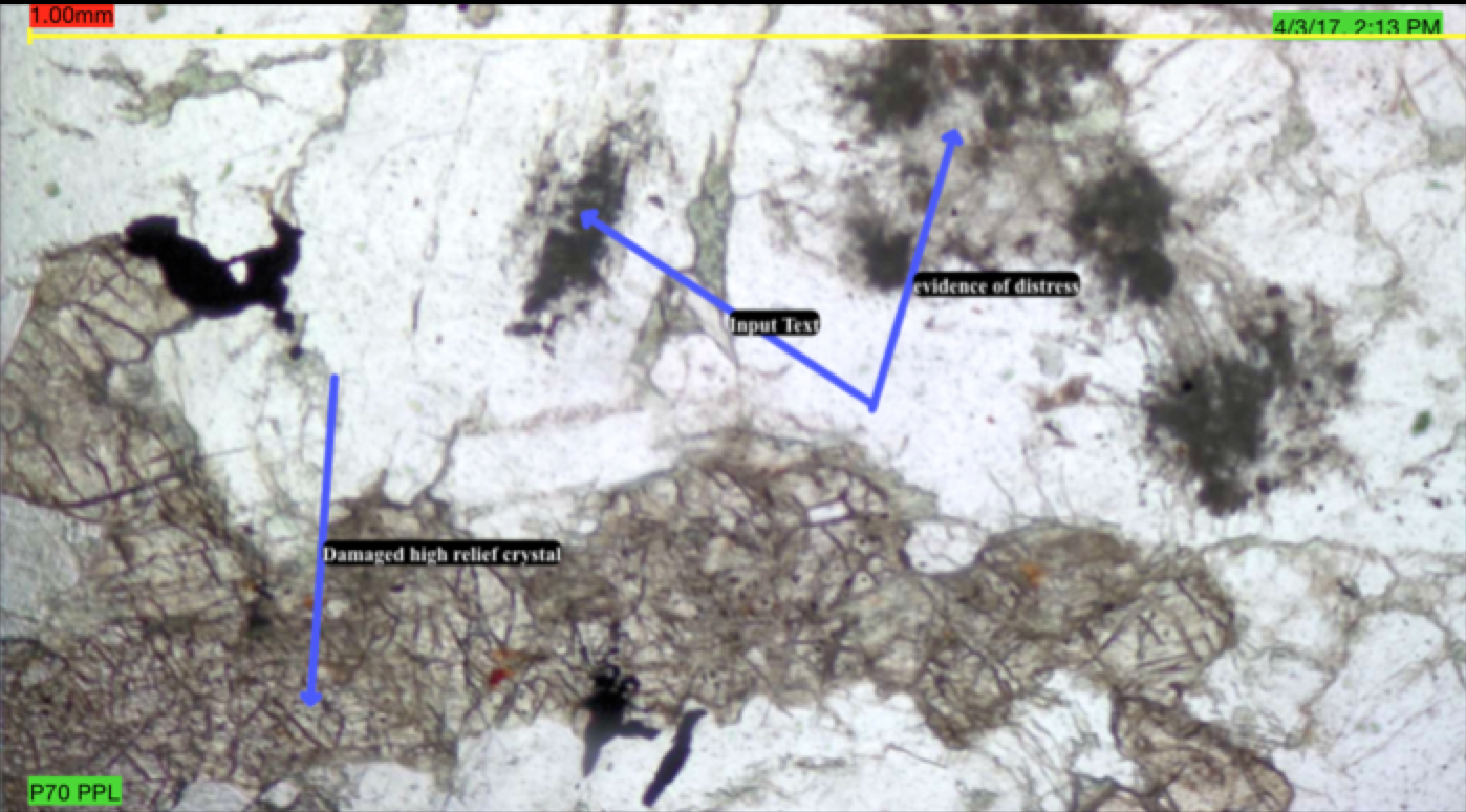
Plane Polarized Thin Section
LMP thin section in Plane Polarized Light. You can make out the high relief minerals.
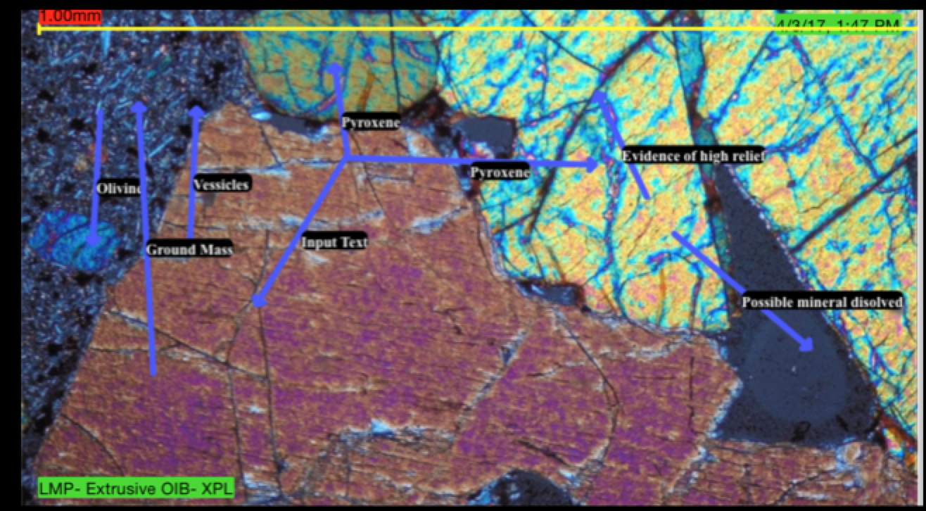
Crossed Polarized Thin Section
Here we see the thin section of an extrusive rock (LMP) in Crossed Polarized view. We see high relief minerals like pyroxene and Olivine. There is some plagioclase present in these rocks. There are also vesicles present with indicate the eruption force. The ground mass does not indicate movement
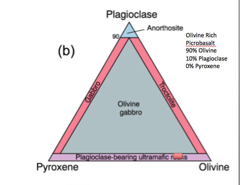
Identification Diagram
Here we see the classification of this rock. It is richer in Plagioclase and Olivine. I misscalculated the amount of pyroxene. there is about 4% pyroxene and 4% plagioclase and 92% Olivine.
Intrusive
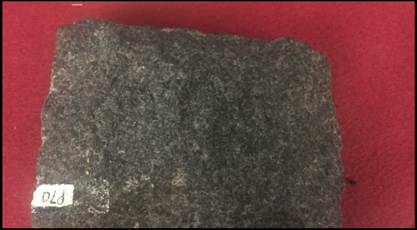
Hand Sample
Plane Polarized Thin Section
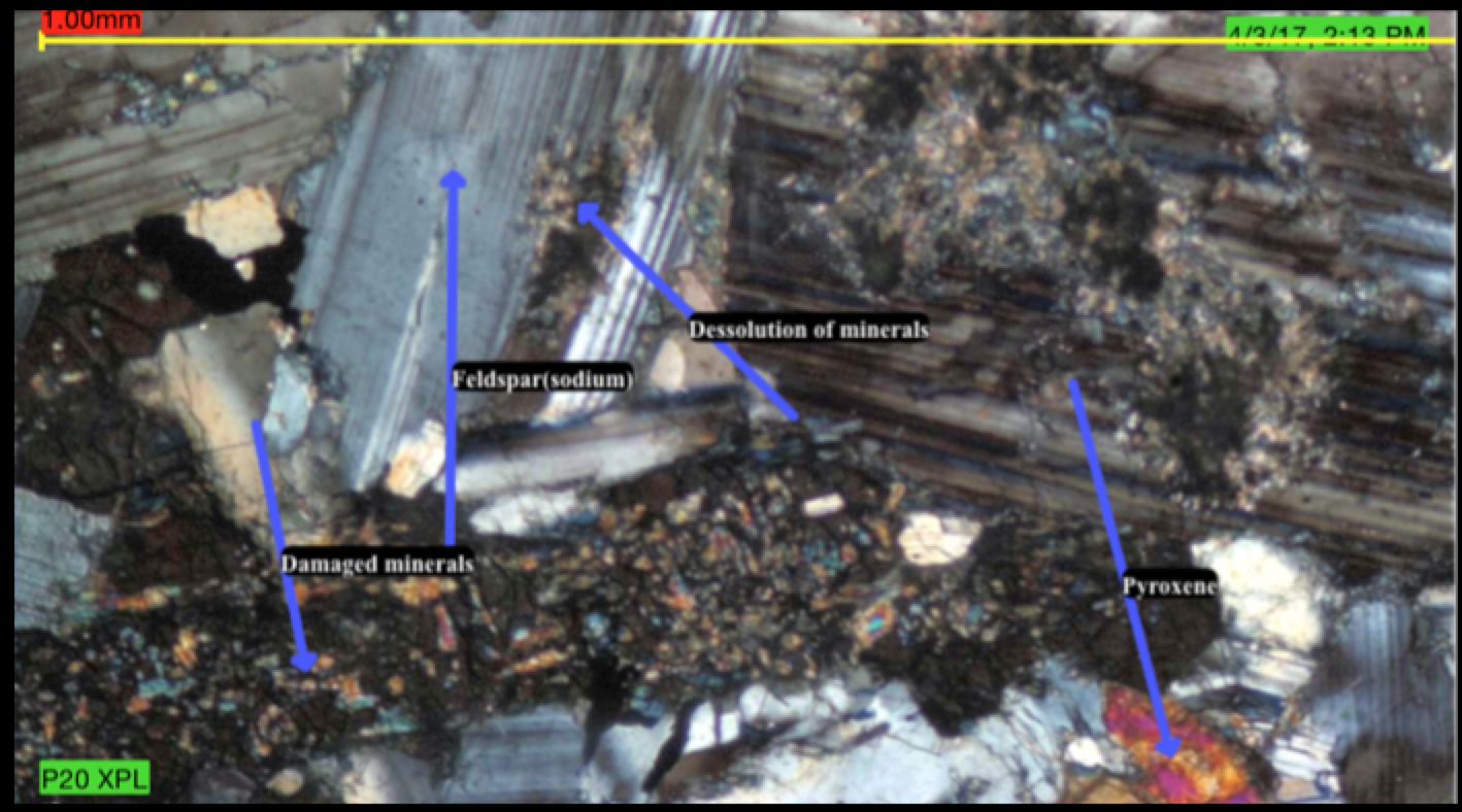
Crossed Polarized Thin Section
This image is rock 70 thin section under Crossed Polarized Light. It has a lot of plagioclase it as we’ll as some pyoxenes. These indicate the mafic minerals. There is not a lot of olivine present in this sample. However, there is dissolution pictured in this rock.
Identification Diagram
This rock is a gabbro. It formed intrusively and it is richh in plagioclase.