January 5th – Cotopaxi Volcano
Hike to the base of the glacier s on Cotopaxi, through freh snow fall. Examine lava flow, spatter and ash stratigraphy.
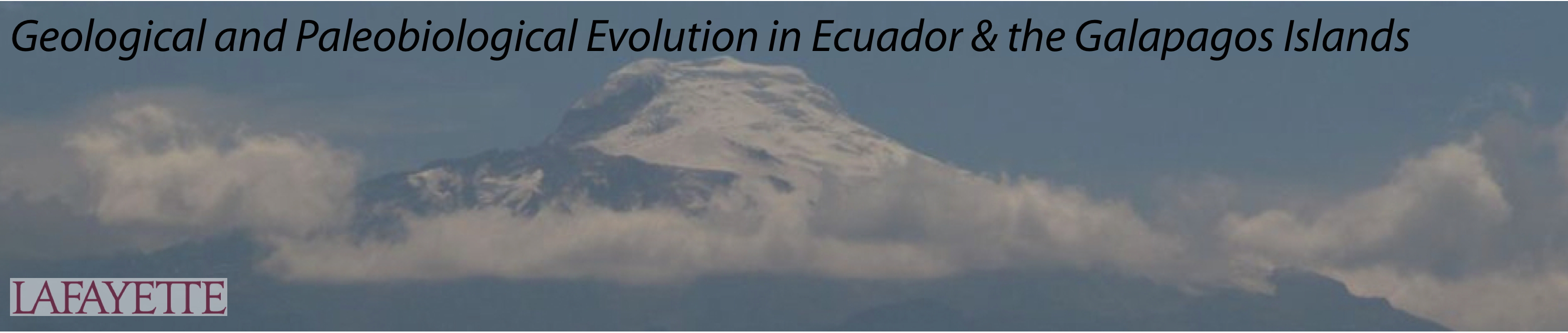
Words cannot describe the incredible physical landform I saw today. The videos and pictures Dr. Malinconico and Dr. Suderlin showed us in the weeks leading up to this trip did not come close to capturing the awe and massive beauty of the Cotopaxi volcano. Cotopaxi is an active volcano and probably the most feared and famous in Ecuador (though it is not the most dangerous).
We left our hotel in Quito at 8am and got to Cotopaxi by 1130 am. We drove to the snow line at 14,000 feet to start our ascent hike. The hike was a little over a mile through volcanic ash deposits (loose little pebbles) at a very steep incline. After 50 steps my heart began to race. I stopped along with the group 3 or 4 times to catch my breath and regain my footing. From the base of the mountain, I assumed the white cap of the mountain was composed entirely of snow. However, the ground upon which we were hiking was filled with bead size hail pellets. These were especially slippery and I was afraid of sliding back down the mountain!
Three fourths of the way to our destination an Ecuadorian man passed us. He was carrying a metal container filled with gas for the rest stop above. While we felt winded and tired, he was an incredible exhibition of lung capacity and strength!
We stopped at the rest stop (at 15,800 feet above sea level!) to eat lunch and talk about the geologic processes which created Cotopaxi. Cotopaxi is a stratovolcano, which means that it was built up by successive deposits from volcanic eruptions. On our descent we investigated rocks left behind by a lava flow. Some were large and dark in color (andesite or basalt porphyry which resulted from thick, slow moving lava flows), while others were more porous and red in color. These red rocks were easily broken and weathered due to their large surface area and probably created by vents close by rather than the main orifice atop Cotopaxi.
As we walked back to the bus, we also examined exposed sediment deposits in the soil. From this we could estimate the number of volcanic flows based on the density and differences between layers. Although these rocks told a vivid story of the destructive capability of Cotopaxi, the landscape also indicated the restorative and constructive consequence of volcanic eruptions. The mafic ash present in volcanic debris contains minerals that act as a fertilizer. There were many crops growing and animals grazing in the valleys below the volcanic peak.
For dinner, we had an authentic Ecuadorian meal at a small restaurant right outside Cotopaxi. Every time I became engrossed in a conversation or eating my meal I would simply look up and see the massive snow-covered peak before me, reminding me I was in Ecuador visiting spectacular volcanic sites!