One Day, Countless Maps. Come celebrate GIS Day at Lafayette college with events that showcase GIS teaching at Lafayette, and the use of GIS across the world. This year, the theme for GIS Day is Powering Purpose and Innovation. Geographic Information Systems, and other geospatial technologies allow information about the world (people, places and things) to be viewed and analyzed by anyone wanting to learn more about the world around them.
GIS Day at Lafayette College will be celebrated by the following events
8:00am-9:15am: Guest Lecture by Caleb Gallemore
Location: Van Wickle 120
Geology 229 class will receive a guest lecture from Caleb Gallemore (IA) speaking about his work using geospatial technologies and coding to understand coffee plantations.
10:35am-11:25am: Guest Lecture by John Wilson
Location: OCGE 107
IA 310 class will receive a guest lecture from John Wilson (GEOL) on the development of aerial photography and aerial photo interpretation.
4:00pm-5:00pm: GIS Day Keynote Presentation. Cassie Bongiovanni (University of Texas)
Location: Location TBA
Mapping the Deep Sea and the Power of Visualization
Abstract:
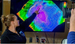
During its first two years in operation, the DSSV Pressure Drop collected more than 1 million km2 of deep sea bathymetric data from some of the deepest places in the world in support of manned-submersible dives and general scientific exploration. This presentation will discuss four major expeditions within these two years and how GIS was critical to the identification of several new seafloor features and species of deep sea life, the deployment of a manned-submersible more than 25 times to the world’s deepest depths, and the success of more than 100 scientific lander deployments. Highlights from the bathymetric data, scientific lander videos, and stories from the expeditions will be shared.
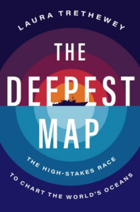
Cassie’s work can be read about in the book “The Deepest Map: The high-stakes race to chart the world’s oceans”(copies available in the College Store).
Biography:
Cassie Bongiovanni got her BS in Geology with a focus in Oceanography at the University of Washington in Seattle. While there, she spent time aboard both UW research vessels working with multibeam data. Cassie then spent a couple of years working with NOAA’s Integrated Ocean and Coastal Mapping group on processing outside source acoustic data for its post-Hurricane Sandy research efforts. Cassie received her MS in Ocean Mapping at University of New Hampshire and, shortly after, led the mapping efforts aboard the DSSV Pressure Drop during the Five Deeps, Calypso, Red Sea, and Ring of Fire 1 Expeditions. Currently, Cassie leads a small team of mapping experts at the Applied Research Laboratories at the University of Texas.
5:00pm-6:00pm: GIS Day Poster Session
Location: TBD
GIS Day poster session. Students from IA 310, Mapping World Cities will be presenting maps highlighting their work on projects about the growth of cities around the globe. Additionally, students from GEOL 229 will be presenting maps showing their work mapping the Lafayette Campus.