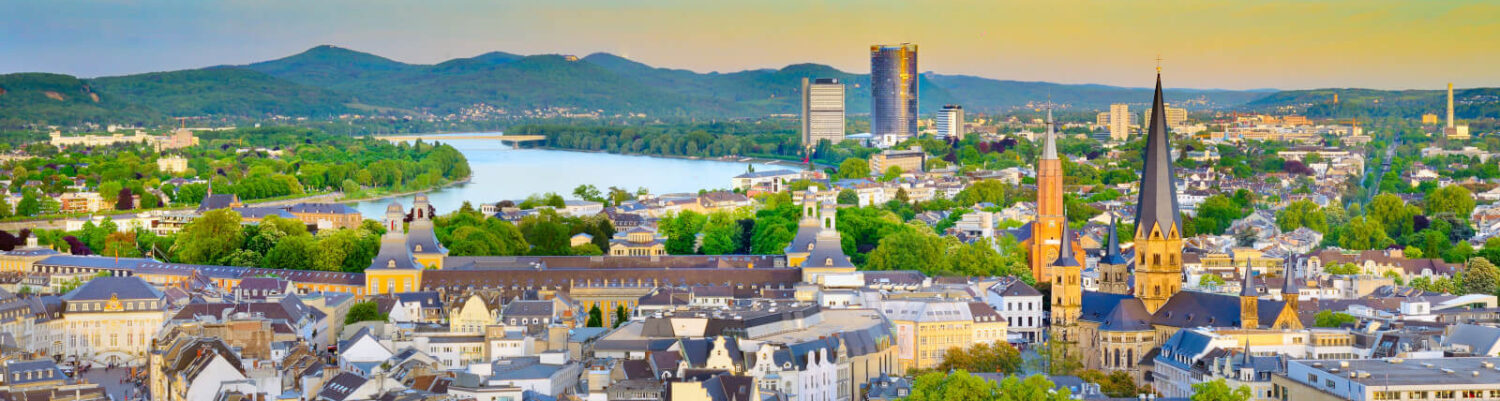
The Flooding River Rhine
This past Sunday, I woke up bright and early at 12:00 pm. After taking my time to eat a standard German breakfast of bread and cold cuts, I decided to explore my neighborhood. While I had walked around downtown extensively, I hadn’t ventured far beyond the route between my house and the bus stop. I set off with no particular plan, just wandering through the adjoining streets to see what was nearby.
I headed south and soon joined the path along the river, which had been recommended by my host family. It was a nice, paved path with trees providing sporadic shade (though this wasn’t necessary given the near-constant overcast weather and cold winter weather). It stretched along the river, from the southern border of the state of North Rhine-Westphalia up to nearby Cologne, and was shared by both cyclists and pedestrians. It is a part of a much larger network that stretches over 750 miles stretching four countries called the EV15 Rhine Cycle Route or Erlebnisweg Rheinschiene in German. It is part of the larger EuroVelo cycling network that stretches across Europe that was founded in 1993.
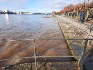
Due to recent rain and snow melt, the water level was quite high, almost level with the very old stone river wall doing its best to keep the river contained. The fast current and occasional barge caused small waves that lapped over the wall, flooding the edges of the path. As I continued walking south (or upriver), the extent of the flooding varied. In some spots, the path was dry, while in others, the entire pedestrian path had become part of the river and claimed by the ducks. In these areas, I had to cross over into the cyclists’ lane, hoping I wouldn’t get hit by a passing bike. At other points, the situation was reversed, and cyclists had to weave through the pedestrian path.
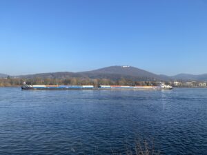
Due to the high water levels, all of the ferries were temporarily shut down, and other shipping was limited. This was what led to my original plan getting canceled as I intended to take the ferry across the river to go hike up to an old castle ruin. However, I still saw a few barges carrying containers and various loose materials. When passing the docks along the path, it was clear why the ferries had been closed. Some of the docks were partially submerged, with the floating platforms sitting too high and debris caught in the chains.
Despite the flooding, the path offers a pleasant middle ground, connecting nature, industry, and the city, with the River Rhine on one side and buildings along the other. Fortunately, the flooding is expected to last only a few weeks and should subside soon, allowing full use of the river and the surrounding parks once again.
-Bram
Sources:
Bonn, G. (2025, January 11). Bilder vom Hochwasser: Rhein überflutet die Ufer in Bonn und der Region. General-Anzeiger Bonn. https://ga.de/fotos/bonn/rhein-in-bonn-fotos-vom-hochwasser-ufer-ueberflutet_bid-122924517#57
Ecf. (n.d.). History of EuroVelo. EuroVelo. https://pro.eurovelo.com/organisation/history
Ecf. (n.d.-a). EuroVelo 15 | Rhine Cycle Route. EuroVelo. https://en.eurovelo.com/ev15
Nice blog Bram! I felt like I was walking along the river with you.