![]()
The Lafayette College chapter of the American Society of Mechanical Engineers (ASME) has undertaken a high altitude design project with the goal of using a Meteorological sounding balloon to carry a photographic platform to the lower stratosphere while taking an HD video of the journey.
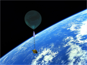
Design- The payload, containing the fully HD camera and a GPS satiate communication tracking device, will be carried into the stratosphere by a helium-filled balloon. At the balloons bursting altitude, it will expand to its limit and pop, dropping the payload back through the atmosphere. At this point it will be slowed by a high speed parachute, and upon reaching earth will be recovered by tracking its GPS signal. The interest gathering, research, planning, design and execution will all take place within a four week time frame.
Descent- The 35 km decent will be slowed by a high altitude, high velocity custom made parachute. Even with this recovery system the payload will reach speeds of over 90 mph in the low density air of the stratosphere.
Stability – The craft will have to survive up to 200 mph winds in the jet streams of the upper atmosphere. To ensure stability, wind tunnel testing has been completed with several wing/fin configurations. Data from this testing will be used to analyze pitch moment and total drag on the payload in order to predict optimal stability.
Thermal stability- the lowest temperature that the balloon will experience will be approximately -70o C. To keep the electronic components functioning and the batteries operating within their thermal limits, chemical hand warmers are included inside the Styrofoam container and both the inside and out will be wrapped in a Mylar emergency blanket to reflect heat back into the vessel. Thermal permeation tests using dry ice to simulate atmospheric temperatures have shown that even with these precautions there will be significant heat loss to the inner chamber. To compensate for this the battery system was over designed with the help of Lafayette’s IEEE.
Tracking and flight path modeling – Wind speed and barring data by altitude was combined with calculated accent and decent rates to model the flight path of the balloon. Extensive research and modeling has gone in to predicting the flight path of the mission in order to choose a launch site and sure its path will not violate restricted air space. The payload will be tracked on ten minute intervals by a GPS active satellite device and its coordinates will be sent to recovery teams on the ground.
Legality- This design conforms to FAA regulations with regard to construction and payload weight, specifically falling under the 4 lb applicability requirement for CFR Title 14 § 101.1 Unmanned Free Balloons. In addition, its launch will respect restricted airspace surrounding local airports.
Significance and future expansion- This low cost, high visual yield project provides engineering students a great opportunity to participate in a true-to-life design project with specific challenges, regulations and a tight time frame to work on. Lead by two first year engineering students, this project has room for much future expansion with larger more sophisticated payloads and interdisciplinary partnership with the IEEE.