Delaware Water Gap
Climbing Style
Mostly traditional with some top roping and a couple of sport routes
Description
The DWG is the largest and most well known climbing area in the vicinity of Lafayette. It attracts climbers from all over Pennsylvania, New Jersey, and New York. The DWG is known for its horizontal cracks and has by far the tallest climbs in the region. Because it is located within the Delaware Water Gap National Recreation Area bolting is prohibited, so climbing is restricted mostly to traditional methods (using cams and nuts to protect climbs yourself). There are a few climbs that are accessible as top ropes, but these are few and far between. Approaches at the gap are generally not too long (usually about 15 minutes) and the cliffs don’t tend to be crowded. There are guide books available and it is highly recommended that you get one so you know what you’re climbing.
Directions
(40.971926, -75.123184). From campus, take Rt. 611 north for about 20 miles until you get to the toll bridge over the Delaware River. After the bridge follow signs for Interstate 80 West. You’ll want to keep left at the first fork after the bridge and then left at the second fork as well, after which you’ll get to I-80. Take I-80 for about 4 miles, then park in the first big pull-off on your right. To get to the climbs you have to walk back along the highway on the trail inside the shoulder barrier. These directions are to get to the NJ side of the Gap, to get to the PA side just look at Googlemaps.
Birdsboro Quarry
Climbing Style
Exclusively sport climbing
Description
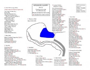
Described by many as an outdoor gym, and looked down upon by many due to its questionable rock quality, this old abandoned quarry nonetheless offers an exciting variety of sport climbs and is by far the best place to go sport climbing near Lafayette. The local climbers are a great, entertaining, and helpful bunch of people and you are guaranteed to have a fair number of fellow climbers on any nice weekend. Climbing styles vary from slabs to overhung jug-hauls, and routes are generally between 4 and 10 bolts high. The Big Wall even has some multi-pitch climbs, all of which are fairly hard (and fun!). You’ll need a harness, shoes, a 50 or 60 meter rope, at least 10 quickdraws, and a helmet. The bird is notorious for sprinkling its’ climbers with loose rocks, so a helmet is a must have.
Directions
(40.254072, -75.813864) From Easton, get on I-78 West and go towards Allentown. You’ll take exit 58 to get onto W Emmaus Ave. Stay on this street (keeping left at both forks) and go through the downtown of Emmaus. On the other side of town this will turn into Rt 29, which you’ll stay on until it turns into Rt 100 (after about 8 miles). Take Rt 100 for about 15 miles until you reach Rt. 422 near Pottstown. Take the exit for 422 West (watch out, it’s a very abrupt exit) and continue on 422 for about 4 miles. At the first stop light take a left, then continue straight through the second stop light and over the bridge. After the bridge take a right onto Rt 724. Follow this road all the way to the town of Birdsboro (about 5 miles) then take a left at the first stop light. Keep going straight until the dead end and park in the parking lot. You’ll have to cross two cable bridges to get to the climbing area, which is about a 10 minute walk from the cars.
Ralph Stover (aka High Rocks)
Climbing Style
Mostly top-roping with a few sketchy sport climbs
Description
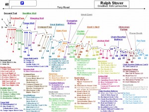
Situated above the Tohickon Creek, this is a beautiful place to spend the day, but definitely won’t offer the best climbing. The cliffs are composed of soft sedimentary rocks that have been climbed on for over 50 years and are subsequently polished smooth. This crag also tends to be frequented by boy scout troops, guided climbing trips, and other large beginner-oriented groups so it can be very crowded. But, if you don’t mind taking the time to set up top ropes and are looking for a nice scenic place to do some climbing this will fit the bill. Bring a rope and anchor building equipment (some climbs have bolted anchors, others require anchoring off trees)
Directions
(40.441125, -75.100511) From Easton, get on Rt 611 south and go about 22 miles. You’ll be turning left off of Rt 611 onto Randts Mill Rd (which will come up right after you pass Dag’s Restaurant). Take your first right to stay on Randts Mill Rd, then after a mile turn right onto Ervin Rd. Take a left at the intersection with E Dark Hollow Rd, and after a half mile turn right onto Stover Park Rd. Keep going until you get into the forest, then take a left onto Tory Rd, and the parking area will be on your left. Walk down the trail across from the parking lot to get to the climbs.
Haycock Mountain (aka Nockamixon Boulders)
Climbing Style
Bouldering
Description
Haycock Mountain, located just to the North of Nockamixon Lake, is a collection of large diabase boulders scattered over a large part of State Game Lands 157. There are about 10 separate collections of boulders, all of which have quality problems but some of which can be quite difficult to find in the woods. Although the boulders can be hard to find, the searching is usually well worth it. With tons of problems ranging from V0 to V10 and high quality rock with lots of friction, Haycock Mtn is the premier pebble-wrestling destination in the Lehigh Valley.
Directions
(40.47575, -75.226784) Take Rt 611 south out of Easton and go about 17 miles until you reach the stop light intersection with Rt. 412. Take a right onto Rt. 412 and go a half a mile before turning left at the first stop light. Go another 3 miles and turn right onto Harrisburg School Rd, then take an immediate right onto Kinzler Road. After about a half mile on this dirt road you’ll see a small pull-off with space for three cars. Park here and walk back up the road a couple hundred yards, cross the stream, then continue up to the Water Tank where there will be a trail off to the left. This trail leads to the Hanger 18 area.

