Welcome to the Geospatial Community of Practice at Lafayette College!
Please use the links below to explore all the ways our community is thinking spatially about complex interdisciplinary problems!
Lafayette College’s Geospatial Community of Practice is a group of students, staff, and faculty interested in how to use geospatial analysis in academic and applied settings. We share experiences and resources and work to provide educational and training opportunities to campus and community members. Our group is open to all students, staff, and faculty interested in geospatial work. Please contact us if you are interested in joining!
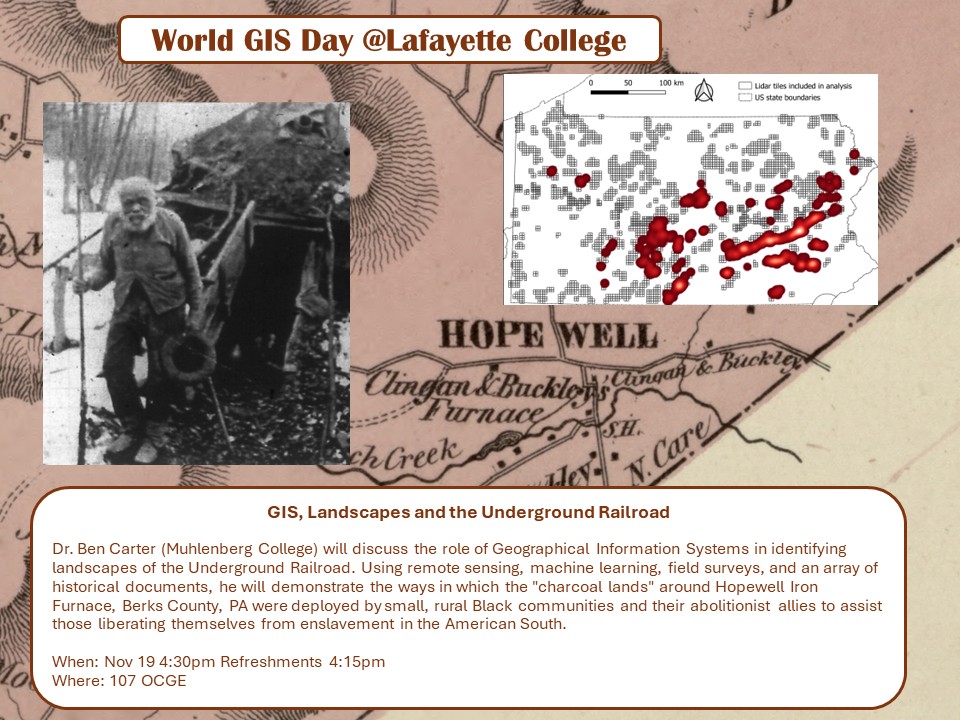
GIS Day 2025: Wednesday November 19th
In reconition of World GIS Day Dr. Ben Carter (Muhlenberg College) will discuss the role of Geographical Information Systems in identifying the role of landscapes in the Underground Railroad. Using remote sensing, machine learning, field survey and an array of historical documents, he will demonstrate the ways in which the “charcoal lands” around Hopewell Iron Furnace, Berks County, PA were deployed by small, rural Black communities and their abolitionist allies to assist those liberating themselves from enslavement in the American South.