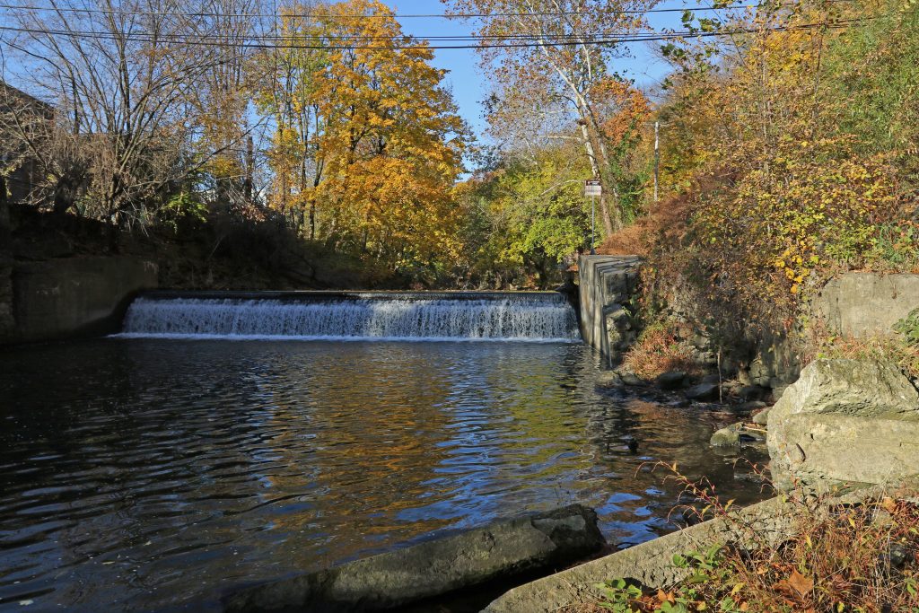
Early November morning at the Bushkill dam
This will be gone in a couple years – imagine the possibilities…
Early November morning at the Bushkill dam
This will be gone in a couple years – imagine the possibilities…
I’m sure that many of you read the recent interview with mayor of Easton Sal Panto in The Lafayette. Hopefully you noticed his comment about vacating part of Bushkill Drive, which would dovetail nicely with our efforts to revitalize the area around the dam and convert the road to a pedestrian area and trail. Vacating a street is an official procedure that a municipality can use to close a road so that it can be developed for another purpose.
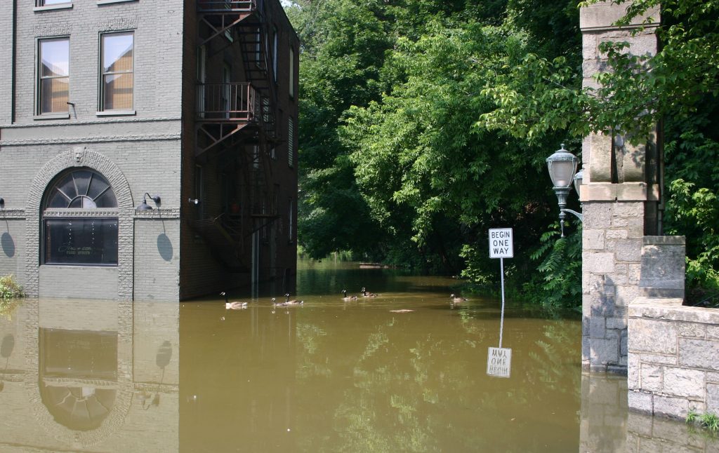
Entrance to Bushkill Drive on June 29 2006
https://news.lafayette.edu/2011/02/18/dam-removal/
This is an article from February, 2011 titled “Student-Faculty Team Studies Implications of Removing Dam along Easton’s Bushkill Creek”…The school had assessed this damn for at least a decade, students have studied and researched the creek, and now we are creating a design concept for this area even though the dam is still there! According to the piece, a map was created of the channel to assess the impact of dam removal. I would like to get my hands on this map so we can begin creating designs based on width of creek at multiple locations of projected area.
Faculty noted in piece are: Steven Mylon, David Brandes, Dru Germanoski, John Wilson, DC Jackson, Art Kney, Megan Rothenberger and Andy Smith.
Go to the FEMA Flood Map Service – at the bottom of the page is a Locator map, zoom way in to Easton. You will see a grid of boxes that correspond to the maps – the map for our area is designated 42095C0279E. Once you select it, some icons will appear at the top – click on the View Map or Save Map icon.
Here is a screenshot:
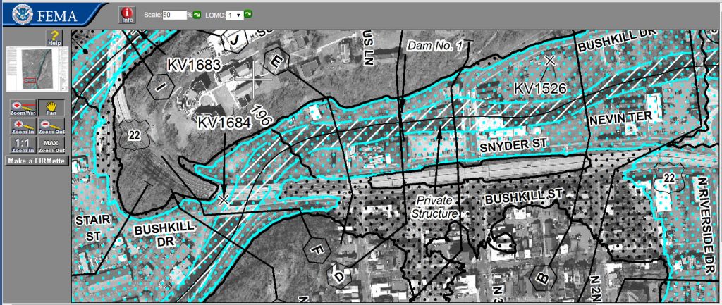
The area with blue dots is within the 100-yr floodplain, and the grey dots are the 500-yr floodplain.