
Go to the FEMA Flood Map Service – at the bottom of the page is a Locator map, zoom way in to Easton. You will see a grid of boxes that correspond to the maps – the map for our area is designated 42095C0279E. Once you select it, some icons will appear at the top – click on the View Map or Save Map icon.
Here is a screenshot:
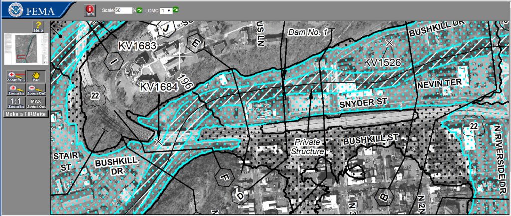
The area with blue dots is within the 100-yr floodplain, and the grey dots are the 500-yr floodplain.