Automated Parking Garages

A major problem experienced by transportation planners wherever space is limited is parking. As transportation becomes easier and more and more people use their vehicles to get around, there has to be space to store these vehicles when not in use. The typical solution is to build a parking lot, however when space is limited this is rarely efficiency enough. A better choice is a conventional parking garage; however their efficiency is limited by the space that needs to be left for cars to make their way in and out. The solution to this issue has been the creation of automated parking systems (APS).

History

Automated parking was first constructed in 1905 in France, however the technology did not see significant usage until the 1970’s. These early systems were prone to mechanical failure and usually increased the amount of time required for drivers to park and retrieve their car. Japanese builders constructed some of the first and most successful systems during that time, as they worked to make the most of the small land area they had available. Interest in the US was limited until late in the 1990’s when the technology had developed enough to lower the likelihood of mechanical errors. In addition to being more space-efficient, these new systems also had a number of other benefits  such as keeping the parked vehicles more secure, and protecting them from damage from careless drivers. One example of a modern automated parking system can be seen in Philadelphia, where designers have created an extremely efficient system to serve their parking needs.

While the concept still feels bizarre to me, I am sure that parking systems such as this will see more and more usage as development continues and land becomes more and more valuable, especially in congested cities such as New York.

Sources:

  • http://en.wikipedia.org/wiki/Automated_Parking_System

Images:

  • http://en.wikipedia.org/wiki/File:SDOT_R7-108P.svg

I-95 Construction


On my way back to Lafayette last weekend, I got to experience firsthand the issues that can be caused by our aging infrastructure. My bus ground to a halt was we made our way through new haven, stopped by miles and miles of construction related congestion. The upside of this situation, however, was I had plenty of time to search the internet and find out just what this slowdown was all about.

Pearl Harbor Memorial Bridge

The backup I was stuck in were the result of an ongoing project to replace the Pearl Harbor Memorial Bridge, which spans the Quinnipiac River (hence the nickname “Q” Bridge) in New Haven The old bridge, opened in 1958, carries 3 lanes in each direction and is loaded far beyond its capacity. The new bridge, under construction now, will carry 6 lanes in each direct and serve a vastly improve ramp network surrounding the bridge. This project will have huge positive impacts on the traffic flow through new haven, however the closures and detours required for the project’s completion will cause significant problems in the meantime. The role of transportation engineers in planning each phase of construction and how the closures will be implemented in clearly huge. The video below talks more about just a few of the hurdles they are overcoming in completing the bridge. The project is set to be completed in 2016.

Sources:

  • http://www.i95newhaven.com/
  • http://en.wikipedia.org/wiki/Pearl_Harbor_Memorial_Bridge_(Connecticut)

Images:

  • http://en.wikipedia.org/wiki/File:Seal_of_the_Connecticut_Department_of_Transportation.svg

HOV Lanes

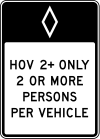
One interesting method for reducing congestion on heavily travelled highways is the use of a High Occupancy Vehicle lane, or HOV lane. These lanes typically require a minimum of two or three occupants in the vehicle, which encourages carpooling and decreases the total load on the roadway.

History

The first HOV lane in the US was implemented in 1969 outside Washington DC. Initially, the lane served only busses but four years later in 1973 it was opened to carpools with 4 or more occupants. Following this first HOV lane’s introduction, implementation slowly increasd across the country, with the greatest usage occurring in and around major metropolitan centers such as New York, Boston, San Fransisco, and Los Angeles. Ride-sharing also became a recommendation of the EPA under the clean air act, further driving increased usage of HOV lanes. Currently, California leads the US with 88 HOV facilities across the state.

Usage and Effectiveness

HOV lanes are implemented in a variety of ways. Some HOV systems are simply a lane within an existing roadway with special marking (usually a white diamond) to differentiate it from the surrpunding lanes. More commonly, the HOV lane is separated from other traffic, as the difference in speed between HOV traffic and regular traffic can pose a safety risk. Where separate lanes are not available but are required, some agencies operate a system with moveable barriers, allowing HOV traffic to run on the un-congested side of the highway during peak flow times. May HOV systems are reversible in this way, allowing them to always operate in the direction of highest demand.

The effectiveness of HOV lanes is often disputed. Every so often, a story makes the news about someone’s absurd scheme to ride in the HOV lane with cadavers or blow-up dolls as additional occupants. While the premise of the HOV lane is a good one, the thought that people will simply give up driving alone for the company of complete strangers is not reasonable. Just as with public transportation, it is tough to draw people away from the convenience of their own cars. Additionally, HOV lane travel is option only marginally faster than the general speed of traffic, and if a one-lane HOV system experiences an accident, the system is essentially shut down. While I do believe that HOV lanes are a useful element of our transportation systems, I do not think their effectiveness is great enough to continue their usage as a traffic congestion solution

A “Zipper” machine moving barricades for a reversible HOV lane

Sources:

  • http://en.wikipedia.org/wiki/High-occupancy_vehicle_lane
  • http://www.dot.ca.gov/hq/traffops/systemops/hov/hov_sys/

Images:

  • http://en.wikipedia.org/wiki/File:MUTCD_R3-10.svg
  • http://www.hawaiihighways.com/H1-zipmobile.jpg